You are here: Home > Network List > US - United States National Seismic Network Stations List
> Station WMOK Wichita Mountains, Oklahoma, USA > Earthquake Result Viewer
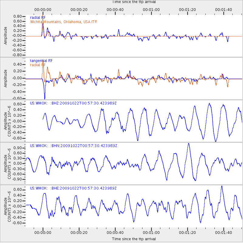
WMOK Wichita Mountains, Oklahoma, USA - Earthquake Result Viewer
*The percent match for this event was below the threshold and hence no stack was calculated.
| Earthquake location: |
South Of Panama |
| Earthquake latitude/longitude: |
6.7/-82.6 |
| Earthquake time(UTC): |
2009/10/22 (295) 00:51:39 GMT |
| Earthquake Depth: |
18 km |
| Earthquake Magnitude: |
5.5 MB, 5.4 MS, 5.9 MW, 5.9 MW |
| Earthquake Catalog/Contributor: |
WHDF/NEIC |
|
| Network: |
US United States National Seismic Network |
| Station: |
WMOK Wichita Mountains, Oklahoma, USA |
| Lat/Lon: |
34.74 N/98.78 W |
| Elevation: |
486 m |
|
| Distance: |
31.6 deg |
| Az: |
334.009 deg |
| Baz: |
148.095 deg |
| Ray Param: |
$rayparam |
*The percent match for this event was below the threshold and hence was not used in the summary stack. |
|
| Radial Match: |
68.96115 % |
| Radial Bump: |
400 |
| Transverse Match: |
68.30567 % |
| Transverse Bump: |
351 |
| SOD ConfigId: |
2622 |
| Insert Time: |
2010-03-05 02:05:53.453 +0000 |
| GWidth: |
2.5 |
| Max Bumps: |
400 |
| Tol: |
0.001 |
|
Signal To Noise
| Channel | StoN | STA | LTA |
| US:WMOK: :BHN:20091022T00:57:30.423989Z | 2.2082767 | 3.701611E-7 | 1.6762442E-7 |
| US:WMOK: :BHE:20091022T00:57:30.423989Z | 1.4078538 | 3.2257938E-7 | 2.2912846E-7 |
| US:WMOK: :BHZ:20091022T00:57:30.423989Z | 2.209505 | 2.939014E-7 | 1.3301685E-7 |
| Arrivals |
| Ps | |
| PpPs | |
| PsPs/PpSs | |


