You are here: Home > Network List > US - United States National Seismic Network Stations List
> Station WMOK Wichita Mountains, Oklahoma, USA > Earthquake Result Viewer
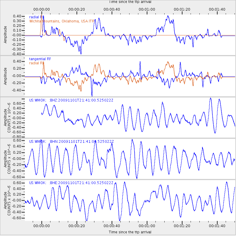
WMOK Wichita Mountains, Oklahoma, USA - Earthquake Result Viewer
*The percent match for this event was below the threshold and hence no stack was calculated.
| Earthquake location: |
Tonga Islands |
| Earthquake latitude/longitude: |
-15.5/-173.8 |
| Earthquake time(UTC): |
2009/11/01 (305) 21:28:58 GMT |
| Earthquake Depth: |
105 km |
| Earthquake Magnitude: |
5.8 MW, 5.4 MB, 5.8 MW |
| Earthquake Catalog/Contributor: |
WHDF/NEIC |
|
| Network: |
US United States National Seismic Network |
| Station: |
WMOK Wichita Mountains, Oklahoma, USA |
| Lat/Lon: |
34.74 N/98.78 W |
| Elevation: |
486 m |
|
| Distance: |
86.8 deg |
| Az: |
52.807 deg |
| Baz: |
248.83 deg |
| Ray Param: |
$rayparam |
*The percent match for this event was below the threshold and hence was not used in the summary stack. |
|
| Radial Match: |
52.108658 % |
| Radial Bump: |
400 |
| Transverse Match: |
61.677788 % |
| Transverse Bump: |
400 |
| SOD ConfigId: |
2622 |
| Insert Time: |
2010-03-05 02:05:56.674 +0000 |
| GWidth: |
2.5 |
| Max Bumps: |
400 |
| Tol: |
0.001 |
|
Signal To Noise
| Channel | StoN | STA | LTA |
| US:WMOK: :BHN:20091101T21:41:00.525022Z | 2.0001965 | 4.392842E-7 | 2.1962053E-7 |
| US:WMOK: :BHE:20091101T21:41:00.525022Z | 0.8710639 | 2.0704795E-7 | 2.3769547E-7 |
| US:WMOK: :BHZ:20091101T21:41:00.525022Z | 0.92974716 | 2.3012745E-7 | 2.4751617E-7 |
| Arrivals |
| Ps | |
| PpPs | |
| PsPs/PpSs | |


