You are here: Home > Network List > US - United States National Seismic Network Stations List
> Station HAWA Hanford, Washington, USA > Earthquake Result Viewer
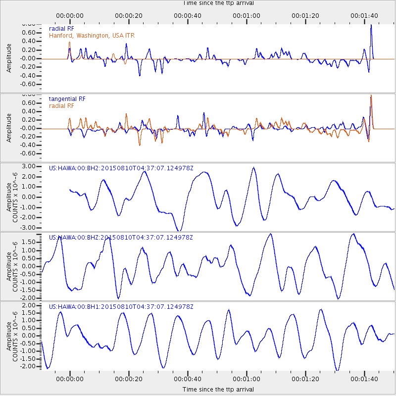
HAWA Hanford, Washington, USA - Earthquake Result Viewer
*The percent match for this event was below the threshold and hence no stack was calculated.
| Earthquake location: |
Solomon Islands |
| Earthquake latitude/longitude: |
-9.3/158.0 |
| Earthquake time(UTC): |
2015/08/10 (222) 04:24:31 GMT |
| Earthquake Depth: |
10 km |
| Earthquake Magnitude: |
5.7 MB |
| Earthquake Catalog/Contributor: |
NEIC PDE/NEIC COMCAT |
|
| Network: |
US United States National Seismic Network |
| Station: |
HAWA Hanford, Washington, USA |
| Lat/Lon: |
46.39 N/119.53 W |
| Elevation: |
364 m |
|
| Distance: |
91.5 deg |
| Az: |
43.352 deg |
| Baz: |
258.22 deg |
| Ray Param: |
$rayparam |
*The percent match for this event was below the threshold and hence was not used in the summary stack. |
|
| Radial Match: |
51.53353 % |
| Radial Bump: |
400 |
| Transverse Match: |
42.127678 % |
| Transverse Bump: |
400 |
| SOD ConfigId: |
1085051 |
| Insert Time: |
2015-08-24 04:41:26.157 +0000 |
| GWidth: |
2.5 |
| Max Bumps: |
400 |
| Tol: |
0.001 |
|
Signal To Noise
| Channel | StoN | STA | LTA |
| US:HAWA:00:BHZ:20150810T04:37:07.124978Z | 3.4395285 | 1.350111E-6 | 3.9252794E-7 |
| US:HAWA:00:BH1:20150810T04:37:07.124978Z | 0.56231976 | 6.4540023E-7 | 1.1477459E-6 |
| US:HAWA:00:BH2:20150810T04:37:07.124978Z | 1.6231419 | 1.5682446E-6 | 9.661784E-7 |
| Arrivals |
| Ps | |
| PpPs | |
| PsPs/PpSs | |


