You are here: Home > Network List > US - United States National Seismic Network Stations List
> Station WMOK Wichita Mountains, Oklahoma, USA > Earthquake Result Viewer
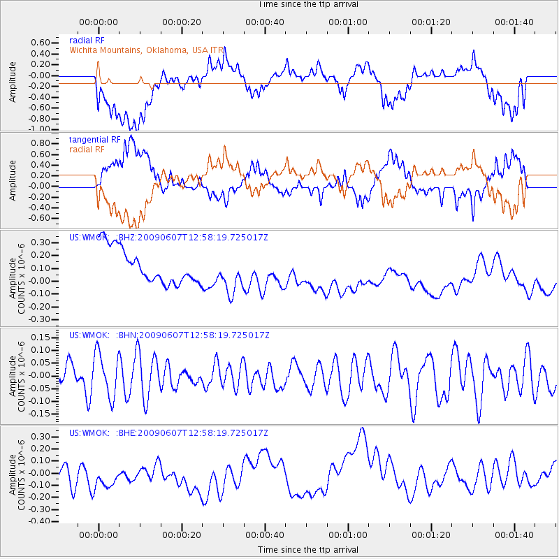
WMOK Wichita Mountains, Oklahoma, USA - Earthquake Result Viewer
*The percent match for this event was below the threshold and hence no stack was calculated.
| Earthquake location: |
South Of Fiji Islands |
| Earthquake latitude/longitude: |
-22.0/-179.6 |
| Earthquake time(UTC): |
2009/06/07 (158) 12:46:30 GMT |
| Earthquake Depth: |
590 km |
| Earthquake Magnitude: |
5.5 MW, 5.1 MB |
| Earthquake Catalog/Contributor: |
WHDF/NEIC |
|
| Network: |
US United States National Seismic Network |
| Station: |
WMOK Wichita Mountains, Oklahoma, USA |
| Lat/Lon: |
34.74 N/98.78 W |
| Elevation: |
486 m |
|
| Distance: |
95.1 deg |
| Az: |
54.71 deg |
| Baz: |
246.863 deg |
| Ray Param: |
$rayparam |
*The percent match for this event was below the threshold and hence was not used in the summary stack. |
|
| Radial Match: |
27.494888 % |
| Radial Bump: |
400 |
| Transverse Match: |
28.874836 % |
| Transverse Bump: |
400 |
| SOD ConfigId: |
2648 |
| Insert Time: |
2010-03-05 02:06:12.421 +0000 |
| GWidth: |
2.5 |
| Max Bumps: |
400 |
| Tol: |
0.001 |
|
Signal To Noise
| Channel | StoN | STA | LTA |
| US:WMOK: :BHN:20090607T12:58:19.725017Z | 1.409359 | 8.7608676E-8 | 6.216207E-8 |
| US:WMOK: :BHE:20090607T12:58:19.725017Z | 1.0606848 | 3.1004322E-7 | 2.9230478E-7 |
| US:WMOK: :BHZ:20090607T12:58:19.725017Z | 1.146197 | 1.5613769E-7 | 1.362224E-7 |
| Arrivals |
| Ps | |
| PpPs | |
| PsPs/PpSs | |


