You are here: Home > Network List > CI - Caltech Regional Seismic Network Stations List
> Station MPM Manuel Prospect Mine, California, USA > Earthquake Result Viewer
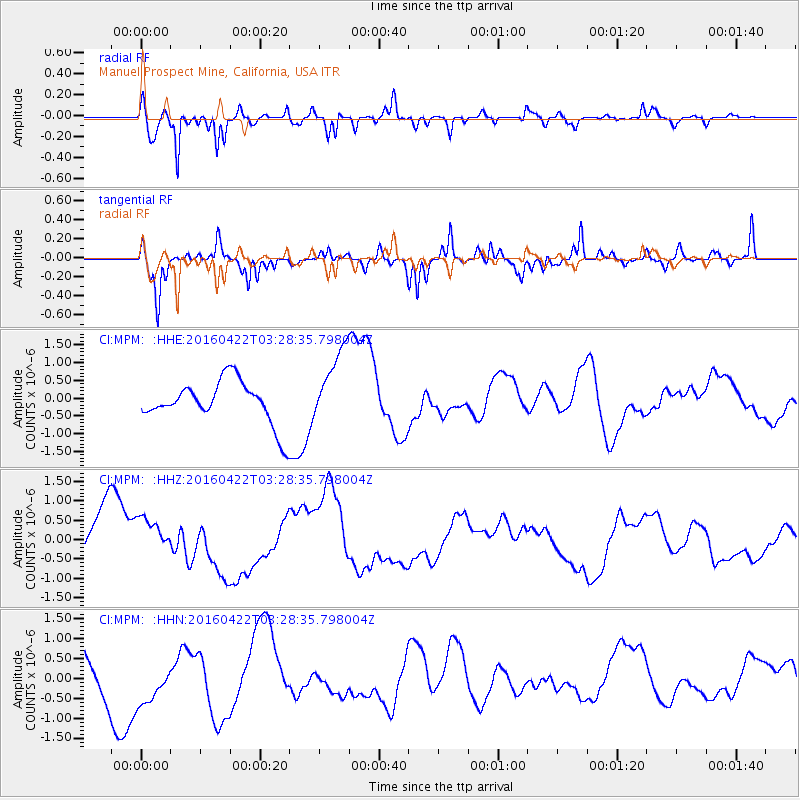
MPM Manuel Prospect Mine, California, USA - Earthquake Result Viewer
*The percent match for this event was below the threshold and hence no stack was calculated.
| Earthquake location: |
Near Coast Of Ecuador |
| Earthquake latitude/longitude: |
-0.3/-80.5 |
| Earthquake time(UTC): |
2016/04/22 (113) 03:20:13 GMT |
| Earthquake Depth: |
10 km |
| Earthquake Magnitude: |
5.8 MO |
| Earthquake Catalog/Contributor: |
NEIC PDE/NEIC ALERT |
|
| Network: |
CI Caltech Regional Seismic Network |
| Station: |
MPM Manuel Prospect Mine, California, USA |
| Lat/Lon: |
36.06 N/117.49 W |
| Elevation: |
185 m |
|
| Distance: |
49.9 deg |
| Az: |
320.402 deg |
| Baz: |
128.131 deg |
| Ray Param: |
$rayparam |
*The percent match for this event was below the threshold and hence was not used in the summary stack. |
|
| Radial Match: |
79.0702 % |
| Radial Bump: |
375 |
| Transverse Match: |
47.487988 % |
| Transverse Bump: |
296 |
| SOD ConfigId: |
7422571 |
| Insert Time: |
2019-04-22 10:39:36.554 +0000 |
| GWidth: |
2.5 |
| Max Bumps: |
400 |
| Tol: |
0.001 |
|
Signal To Noise
| Channel | StoN | STA | LTA |
| CI:MPM: :HHZ:20160422T03:28:35.798004Z | 1.1372347 | 5.910344E-7 | 5.197119E-7 |
| CI:MPM: :HHN:20160422T03:28:35.798004Z | 0.69435513 | 6.1650934E-7 | 8.878877E-7 |
| CI:MPM: :HHE:20160422T03:28:35.798004Z | 1.7259012 | 9.992416E-7 | 5.78968E-7 |
| Arrivals |
| Ps | |
| PpPs | |
| PsPs/PpSs | |


