You are here: Home > Network List > TA - USArray Transportable Network (new EarthScope stations) Stations List
> Station M31M Drury Creek, Yukon, CA > Earthquake Result Viewer
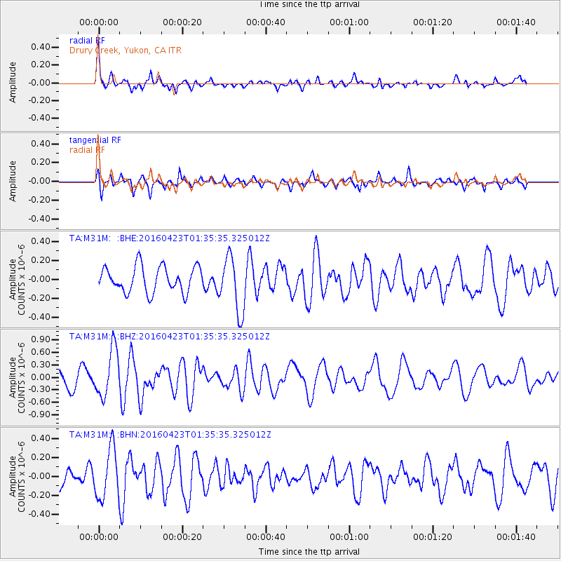
M31M Drury Creek, Yukon, CA - Earthquake Result Viewer
*The percent match for this event was below the threshold and hence no stack was calculated.
| Earthquake location: |
Near Coast Of Ecuador |
| Earthquake latitude/longitude: |
0.6/-80.3 |
| Earthquake time(UTC): |
2016/04/23 (114) 01:24:34 GMT |
| Earthquake Depth: |
10 km |
| Earthquake Magnitude: |
5.8 MWP |
| Earthquake Catalog/Contributor: |
NEIC PDE/NEIC COMCAT |
|
| Network: |
TA USArray Transportable Network (new EarthScope stations) |
| Station: |
M31M Drury Creek, Yukon, CA |
| Lat/Lon: |
62.20 N/134.39 W |
| Elevation: |
639 m |
|
| Distance: |
73.5 deg |
| Az: |
336.662 deg |
| Baz: |
122.329 deg |
| Ray Param: |
$rayparam |
*The percent match for this event was below the threshold and hence was not used in the summary stack. |
|
| Radial Match: |
76.79985 % |
| Radial Bump: |
390 |
| Transverse Match: |
59.872818 % |
| Transverse Bump: |
400 |
| SOD ConfigId: |
7422571 |
| Insert Time: |
2019-04-22 10:55:59.510 +0000 |
| GWidth: |
2.5 |
| Max Bumps: |
400 |
| Tol: |
0.001 |
|
Signal To Noise
| Channel | StoN | STA | LTA |
| TA:M31M: :BHZ:20160423T01:35:35.325012Z | 3.6985335 | 5.9331205E-7 | 1.6041818E-7 |
| TA:M31M: :BHN:20160423T01:35:35.325012Z | 2.05044 | 2.7298975E-7 | 1.3313715E-7 |
| TA:M31M: :BHE:20160423T01:35:35.325012Z | 2.2521608 | 3.0594836E-7 | 1.3584659E-7 |
| Arrivals |
| Ps | |
| PpPs | |
| PsPs/PpSs | |


