You are here: Home > Network List > TA - USArray Transportable Network (new EarthScope stations) Stations List
> Station TPFO Pinon Flats, CA, USA > Earthquake Result Viewer
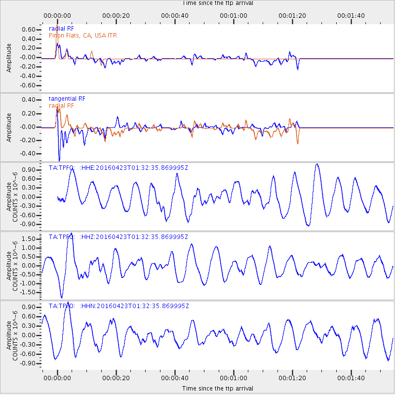
TPFO Pinon Flats, CA, USA - Earthquake Result Viewer
*The percent match for this event was below the threshold and hence no stack was calculated.
| Earthquake location: |
Near Coast Of Ecuador |
| Earthquake latitude/longitude: |
0.6/-80.3 |
| Earthquake time(UTC): |
2016/04/23 (114) 01:24:34 GMT |
| Earthquake Depth: |
10 km |
| Earthquake Magnitude: |
5.8 MWP |
| Earthquake Catalog/Contributor: |
NEIC PDE/NEIC COMCAT |
|
| Network: |
TA USArray Transportable Network (new EarthScope stations) |
| Station: |
TPFO Pinon Flats, CA, USA |
| Lat/Lon: |
33.61 N/116.45 W |
| Elevation: |
1275 m |
|
| Distance: |
47.2 deg |
| Az: |
317.824 deg |
| Baz: |
126.442 deg |
| Ray Param: |
$rayparam |
*The percent match for this event was below the threshold and hence was not used in the summary stack. |
|
| Radial Match: |
57.91896 % |
| Radial Bump: |
400 |
| Transverse Match: |
78.73345 % |
| Transverse Bump: |
400 |
| SOD ConfigId: |
7422571 |
| Insert Time: |
2019-04-22 10:56:21.315 +0000 |
| GWidth: |
2.5 |
| Max Bumps: |
400 |
| Tol: |
0.001 |
|
Signal To Noise
| Channel | StoN | STA | LTA |
| TA:TPFO: :HHZ:20160423T01:32:35.869995Z | 2.8397498 | 1.2246878E-6 | 4.3126613E-7 |
| TA:TPFO: :HHN:20160423T01:32:35.869995Z | 1.7644387 | 7.108305E-7 | 4.0286494E-7 |
| TA:TPFO: :HHE:20160423T01:32:35.869995Z | 1.1380582 | 3.9982535E-7 | 3.5132243E-7 |
| Arrivals |
| Ps | |
| PpPs | |
| PsPs/PpSs | |


