You are here: Home > Network List > AK - Alaska Regional Network Stations List
> Station MDM Murphy Dome > Earthquake Result Viewer
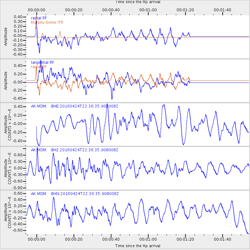
MDM Murphy Dome - Earthquake Result Viewer
*The percent match for this event was below the threshold and hence no stack was calculated.
| Earthquake location: |
Tonga Islands |
| Earthquake latitude/longitude: |
-17.7/-173.2 |
| Earthquake time(UTC): |
2016/04/24 (115) 22:24:36 GMT |
| Earthquake Depth: |
27 km |
| Earthquake Magnitude: |
5.7 MWW, 5.6 MWB, 5.7 MWC |
| Earthquake Catalog/Contributor: |
NEIC PDE/NEIC COMCAT |
|
| Network: |
AK Alaska Regional Network |
| Station: |
MDM Murphy Dome |
| Lat/Lon: |
64.96 N/148.23 W |
| Elevation: |
634 m |
|
| Distance: |
84.6 deg |
| Az: |
10.399 deg |
| Baz: |
203.846 deg |
| Ray Param: |
$rayparam |
*The percent match for this event was below the threshold and hence was not used in the summary stack. |
|
| Radial Match: |
47.91686 % |
| Radial Bump: |
400 |
| Transverse Match: |
22.38803 % |
| Transverse Bump: |
400 |
| SOD ConfigId: |
7422571 |
| Insert Time: |
2019-04-22 11:04:39.800 +0000 |
| GWidth: |
2.5 |
| Max Bumps: |
400 |
| Tol: |
0.001 |
|
Signal To Noise
| Channel | StoN | STA | LTA |
| AK:MDM: :BHZ:20160424T22:36:35.908008Z | 2.3149157 | 3.4492555E-7 | 1.4900135E-7 |
| AK:MDM: :BHN:20160424T22:36:35.908008Z | 0.7975539 | 1.8240249E-7 | 2.287024E-7 |
| AK:MDM: :BHE:20160424T22:36:35.908008Z | 1.0088078 | 1.693132E-7 | 1.6783493E-7 |
| Arrivals |
| Ps | |
| PpPs | |
| PsPs/PpSs | |


