You are here: Home > Network List > UW - Pacific Northwest Regional Seismic Network Stations List
> Station OMAK Colville Reservation, Omak, WA, USA > Earthquake Result Viewer
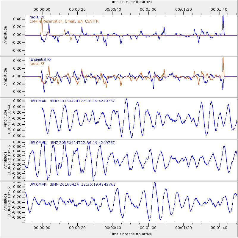
OMAK Colville Reservation, Omak, WA, USA - Earthquake Result Viewer
*The percent match for this event was below the threshold and hence no stack was calculated.
| Earthquake location: |
Tonga Islands |
| Earthquake latitude/longitude: |
-17.7/-173.2 |
| Earthquake time(UTC): |
2016/04/24 (115) 22:24:36 GMT |
| Earthquake Depth: |
27 km |
| Earthquake Magnitude: |
5.7 MWW, 5.6 MWB, 5.7 MWC |
| Earthquake Catalog/Contributor: |
NEIC PDE/NEIC COMCAT |
|
| Network: |
UW Pacific Northwest Regional Seismic Network |
| Station: |
OMAK Colville Reservation, Omak, WA, USA |
| Lat/Lon: |
48.36 N/119.33 W |
| Elevation: |
696 m |
|
| Distance: |
81.4 deg |
| Az: |
33.013 deg |
| Baz: |
231.143 deg |
| Ray Param: |
$rayparam |
*The percent match for this event was below the threshold and hence was not used in the summary stack. |
|
| Radial Match: |
71.43578 % |
| Radial Bump: |
400 |
| Transverse Match: |
66.63755 % |
| Transverse Bump: |
400 |
| SOD ConfigId: |
7422571 |
| Insert Time: |
2019-04-22 11:10:24.025 +0000 |
| GWidth: |
2.5 |
| Max Bumps: |
400 |
| Tol: |
0.001 |
|
Signal To Noise
| Channel | StoN | STA | LTA |
| UW:OMAK: :BHZ:20160424T22:36:19.424976Z | 2.4528232 | 6.387279E-7 | 2.604052E-7 |
| UW:OMAK: :BHN:20160424T22:36:19.424976Z | 0.33608034 | 7.6527414E-8 | 2.2770573E-7 |
| UW:OMAK: :BHE:20160424T22:36:19.424976Z | 0.53076065 | 1.4290207E-7 | 2.6924013E-7 |
| Arrivals |
| Ps | |
| PpPs | |
| PsPs/PpSs | |


