MSO Missoula, Montana, USA - Earthquake Result Viewer
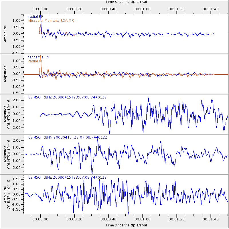
Earthquake location: Andreanof Islands, Aleutian Is.
Earthquake latitude/longitude: 51.9/-179.4
Earthquake time(UTC): 2008/04/15 (106) 22:59:51 GMT
Earthquake Depth: 10 km
Earthquake Magnitude: 6.1 MB, 6.4 MS, 6.4 MW, 6.4 MW
Earthquake Catalog/Contributor: WHDF/NEIC
Network: US United States National Seismic Network
Station: MSO Missoula, Montana, USA
Lat/Lon: 46.83 N/113.94 W
Elevation: 1264 m
Distance: 41.6 deg
Az: 70.032 deg
Baz: 301.896 deg
Ray Param: 0.07367112
Estimated Moho Depth: 59.0 km
Estimated Crust Vp/Vs: 2.07
Assumed Crust Vp: 6.353 km/s
Estimated Crust Vs: 3.073 km/s
Estimated Crust Poisson's Ratio: 0.35
Radial Match: 93.42402 %
Radial Bump: 400
Transverse Match: 74.14108 %
Transverse Bump: 400
SOD ConfigId: 2504
Insert Time: 2010-03-05 02:10:50.241 +0000
GWidth: 2.5
Max Bumps: 400
Tol: 0.001

Signal To Noise

ChannelStoNSTALTA
US:MSO: :BHN:20080415T23:07:08.744012Z6.05067065.012982E-78.2850015E-8
US:MSO: :BHE:20080415T23:07:08.744012Z3.5230973.289594E-79.337222E-8
US:MSO: :BHZ:20080415T23:07:08.744012Z3.58158735.841899E-71.6310922E-7
Arrivals
Ps10 SECOND
PpPs27 SECOND
PsPs/PpSs37 SECOND