MSO Missoula, Montana, USA - Earthquake Result Viewer
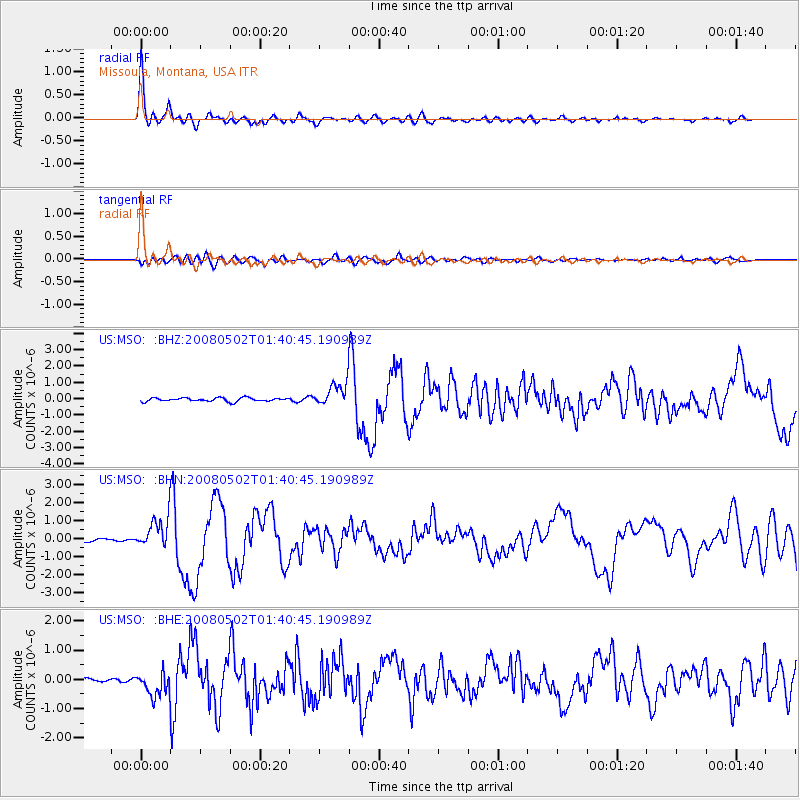
Earthquake location: Andreanof Islands, Aleutian Is.
Earthquake latitude/longitude: 51.9/-177.5
Earthquake time(UTC): 2008/05/02 (123) 01:33:37 GMT
Earthquake Depth: 14 km
Earthquake Magnitude: 6.3 MB, 6.8 MS, 6.6 MW, 6.6 MW
Earthquake Catalog/Contributor: WHDF/NEIC
Network: US United States National Seismic Network
Station: MSO Missoula, Montana, USA
Lat/Lon: 46.83 N/113.94 W
Elevation: 1264 m
Distance: 40.6 deg
Az: 71.045 deg
Baz: 301.335 deg
Ray Param: 0.074322194
Estimated Moho Depth: 25.25 km
Estimated Crust Vp/Vs: 2.10
Assumed Crust Vp: 6.353 km/s
Estimated Crust Vs: 3.029 km/s
Estimated Crust Poisson's Ratio: 0.35
Radial Match: 94.125885 %
Radial Bump: 400
Transverse Match: 74.079926 %
Transverse Bump: 400
SOD ConfigId: 2504
Insert Time: 2010-03-05 02:10:56.107 +0000
GWidth: 2.5
Max Bumps: 400
Tol: 0.001

Signal To Noise

ChannelStoNSTALTA
US:MSO: :BHN:20080502T01:40:45.190989Z10.4753068.4148485E-78.033034E-8
US:MSO: :BHE:20080502T01:40:45.190989Z3.10557843.973915E-71.2796055E-7
US:MSO: :BHZ:20080502T01:40:45.190989Z6.5575997.144641E-71.0895208E-7
Arrivals
Ps4.6 SECOND
PpPs12 SECOND
PsPs/PpSs16 SECOND