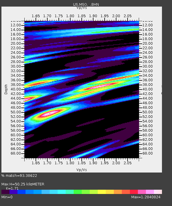
MSO Missoula, Montana, USA - Earthquake Result Viewer
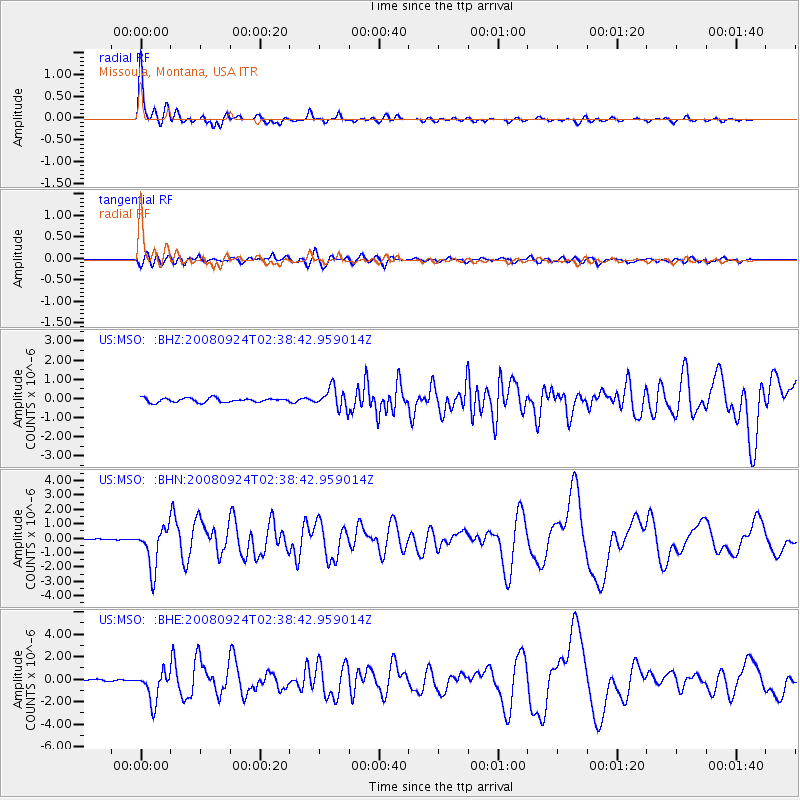
Earthquake location: Off Coast Of Jalisco, Mexico
Earthquake latitude/longitude: 17.6/-105.5
Earthquake time(UTC): 2008/09/24 (268) 02:33:05 GMT
Earthquake Depth: 10 km
Earthquake Magnitude: 5.7 MB, 6.2 MS, 6.4 MW, 6.4 MW
Earthquake Catalog/Contributor: WHDF/NEIC
Network: US United States National Seismic Network
Station: MSO Missoula, Montana, USA
Lat/Lon: 46.83 N/113.94 W
Elevation: 1264 m
Distance: 30.0 deg
Az: 348.359 deg
Baz: 163.723 deg
Ray Param: 0.0794564
Estimated Moho Depth: 50.25 km
Estimated Crust Vp/Vs: 1.71
Assumed Crust Vp: 6.353 km/s
Estimated Crust Vs: 3.715 km/s
Estimated Crust Poisson's Ratio: 0.24
Radial Match: 93.38622 %
Radial Bump: 400
Transverse Match: 73.62731 %
Transverse Bump: 400
SOD ConfigId: 2560
Insert Time: 2010-03-05 02:11:47.465 +0000
GWidth: 2.5
Max Bumps: 400
Tol: 0.001

Signal To Noise

ChannelStoNSTALTA
US:MSO: :BHN:20080924T02:38:42.959014Z34.7057271.4410355E-64.1521545E-8
US:MSO: :BHE:20080924T02:38:42.959014Z15.16225051.3361841E-68.812571E-8
US:MSO: :BHZ:20080924T02:38:42.959014Z5.0669995.437219E-71.07306505E-7
Arrivals
Ps6.1 SECOND
PpPs20 SECOND
PsPs/PpSs26 SECOND