You are here: Home > Network List > TA - USArray Transportable Network (new EarthScope stations) Stations List
> Station I23K Minto, Yukon-Koyukuk, AK, USA > Earthquake Result Viewer
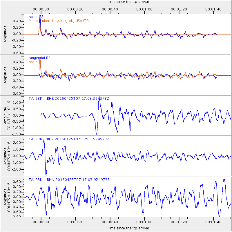
I23K Minto, Yukon-Koyukuk, AK, USA - Earthquake Result Viewer
*The percent match for this event was below the threshold and hence no stack was calculated.
| Earthquake location: |
Near Coast Of Chiapas, Mexico |
| Earthquake latitude/longitude: |
14.4/-93.1 |
| Earthquake time(UTC): |
2016/04/25 (116) 07:07:09 GMT |
| Earthquake Depth: |
26 km |
| Earthquake Magnitude: |
5.6 MB |
| Earthquake Catalog/Contributor: |
NEIC PDE/NEIC COMCAT |
|
| Network: |
TA USArray Transportable Network (new EarthScope stations) |
| Station: |
I23K Minto, Yukon-Koyukuk, AK, USA |
| Lat/Lon: |
65.15 N/149.36 W |
| Elevation: |
149 m |
|
| Distance: |
63.2 deg |
| Az: |
336.806 deg |
| Baz: |
115.443 deg |
| Ray Param: |
$rayparam |
*The percent match for this event was below the threshold and hence was not used in the summary stack. |
|
| Radial Match: |
78.67958 % |
| Radial Bump: |
356 |
| Transverse Match: |
67.65202 % |
| Transverse Bump: |
400 |
| SOD ConfigId: |
7422571 |
| Insert Time: |
2019-04-22 11:17:45.746 +0000 |
| GWidth: |
2.5 |
| Max Bumps: |
400 |
| Tol: |
0.001 |
|
Signal To Noise
| Channel | StoN | STA | LTA |
| TA:I23K: :BHZ:20160425T07:17:03.924973Z | 6.579696 | 1.4246904E-6 | 2.1652829E-7 |
| TA:I23K: :BHN:20160425T07:17:03.924973Z | 2.3696942 | 3.383733E-7 | 1.4279198E-7 |
| TA:I23K: :BHE:20160425T07:17:03.924973Z | 6.4635243 | 8.4699116E-7 | 1.3104169E-7 |
| Arrivals |
| Ps | |
| PpPs | |
| PsPs/PpSs | |


