You are here: Home > Network List > US - United States National Seismic Network Stations List
> Station EGMT Eagleton, Montana, USA > Earthquake Result Viewer
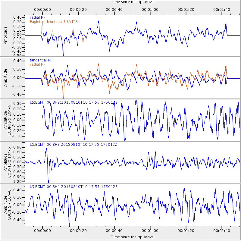
EGMT Eagleton, Montana, USA - Earthquake Result Viewer
*The percent match for this event was below the threshold and hence no stack was calculated.
| Earthquake location: |
Afghanistan-Tajikistan Bord Reg. |
| Earthquake latitude/longitude: |
36.5/71.2 |
| Earthquake time(UTC): |
2015/08/10 (222) 10:05:25 GMT |
| Earthquake Depth: |
223 km |
| Earthquake Magnitude: |
5.7 MB |
| Earthquake Catalog/Contributor: |
NEIC PDE/NEIC COMCAT |
|
| Network: |
US United States National Seismic Network |
| Station: |
EGMT Eagleton, Montana, USA |
| Lat/Lon: |
48.02 N/109.75 W |
| Elevation: |
1055 m |
|
| Distance: |
95.8 deg |
| Az: |
0.646 deg |
| Baz: |
359.224 deg |
| Ray Param: |
$rayparam |
*The percent match for this event was below the threshold and hence was not used in the summary stack. |
|
| Radial Match: |
56.648434 % |
| Radial Bump: |
400 |
| Transverse Match: |
50.690567 % |
| Transverse Bump: |
400 |
| SOD ConfigId: |
1085051 |
| Insert Time: |
2015-08-24 10:42:27.212 +0000 |
| GWidth: |
2.5 |
| Max Bumps: |
400 |
| Tol: |
0.001 |
|
Signal To Noise
| Channel | StoN | STA | LTA |
| US:EGMT:00:BHZ:20150810T10:17:55.175012Z | 8.578848 | 4.96177E-7 | 5.7837248E-8 |
| US:EGMT:00:BH1:20150810T10:17:55.175012Z | 1.1824025 | 1.480581E-7 | 1.2521804E-7 |
| US:EGMT:00:BH2:20150810T10:17:55.175012Z | 0.87211424 | 1.3034102E-7 | 1.4945407E-7 |
| Arrivals |
| Ps | |
| PpPs | |
| PsPs/PpSs | |


