
MSO Missoula, Montana, USA - Earthquake Result Viewer
| ||||||||||||||||||
| ||||||||||||||||||
| ||||||||||||||||||
|
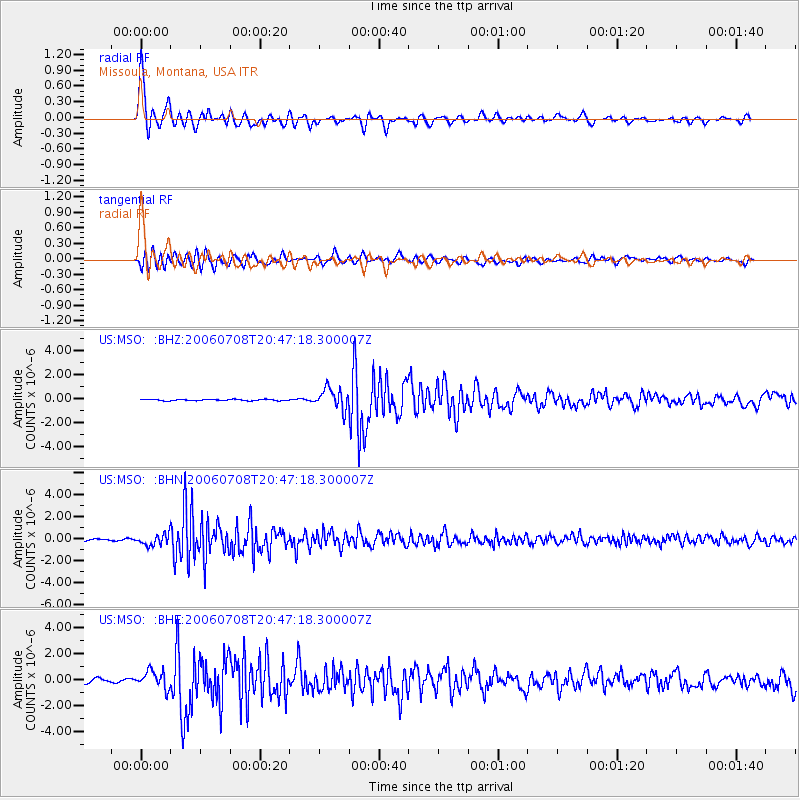
Signal To Noise
| Channel | StoN | STA | LTA |
| US:MSO: :BHN:20060708T20:47:18.300007Z | 4.66616 | 5.0005036E-7 | 1.0716528E-7 |
| US:MSO: :BHE:20060708T20:47:18.300007Z | 5.0228925 | 6.569689E-7 | 1.3079493E-7 |
| US:MSO: :BHZ:20060708T20:47:18.300007Z | 15.87129 | 8.5601016E-7 | 5.3934503E-8 |
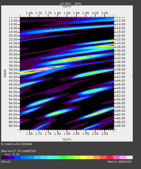
| Arrivals | |
| Ps | 4.6 SECOND |
| PpPs | 15 SECOND |
| PsPs/PpSs | 20 SECOND |

