You are here: Home > Network List > CI - Caltech Regional Seismic Network Stations List
> Station MPP McPhearson Peak > Earthquake Result Viewer
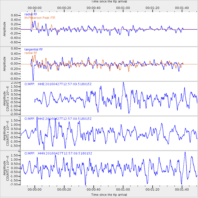
MPP McPhearson Peak - Earthquake Result Viewer
*The percent match for this event was below the threshold and hence no stack was calculated.
| Earthquake location: |
Near Coast Of Chiapas, Mexico |
| Earthquake latitude/longitude: |
14.6/-93.0 |
| Earthquake time(UTC): |
2016/04/27 (118) 12:51:22 GMT |
| Earthquake Depth: |
35 km |
| Earthquake Magnitude: |
5.8 MB |
| Earthquake Catalog/Contributor: |
NEIC PDE/NEIC COMCAT |
|
| Network: |
CI Caltech Regional Seismic Network |
| Station: |
MPP McPhearson Peak |
| Lat/Lon: |
34.89 N/119.81 W |
| Elevation: |
1739 m |
|
| Distance: |
31.5 deg |
| Az: |
314.743 deg |
| Baz: |
123.221 deg |
| Ray Param: |
$rayparam |
*The percent match for this event was below the threshold and hence was not used in the summary stack. |
|
| Radial Match: |
71.66629 % |
| Radial Bump: |
400 |
| Transverse Match: |
70.71506 % |
| Transverse Bump: |
384 |
| SOD ConfigId: |
7422571 |
| Insert Time: |
2019-04-22 11:26:59.179 +0000 |
| GWidth: |
2.5 |
| Max Bumps: |
400 |
| Tol: |
0.001 |
|
Signal To Noise
| Channel | StoN | STA | LTA |
| CI:MPP: :HHZ:20160427T12:57:09.518015Z | 3.3348463 | 7.928534E-7 | 2.3774811E-7 |
| CI:MPP: :HHN:20160427T12:57:09.518015Z | 1.2212807 | 5.687862E-7 | 4.657293E-7 |
| CI:MPP: :HHE:20160427T12:57:09.518015Z | 1.1878843 | 5.078301E-7 | 4.275081E-7 |
| Arrivals |
| Ps | |
| PpPs | |
| PsPs/PpSs | |


