You are here: Home > Network List > US - United States National Seismic Network Stations List
> Station MSO Missoula, Montana, USA > Earthquake Result Viewer
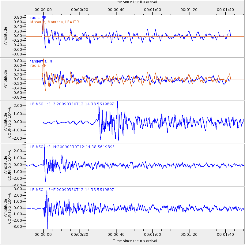
MSO Missoula, Montana, USA - Earthquake Result Viewer
*The percent match for this event was below the threshold and hence no stack was calculated.
| Earthquake location: |
Andreanof Islands, Aleutian Is. |
| Earthquake latitude/longitude: |
51.5/-178.3 |
| Earthquake time(UTC): |
2009/03/30 (089) 12:07:28 GMT |
| Earthquake Depth: |
31 km |
| Earthquake Magnitude: |
6.0 MB, 5.5 MS, 5.7 MW, 5.7 MW |
| Earthquake Catalog/Contributor: |
WHDF/NEIC |
|
| Network: |
US United States National Seismic Network |
| Station: |
MSO Missoula, Montana, USA |
| Lat/Lon: |
46.83 N/113.94 W |
| Elevation: |
1264 m |
|
| Distance: |
41.1 deg |
| Az: |
70.288 deg |
| Baz: |
301.089 deg |
| Ray Param: |
$rayparam |
*The percent match for this event was below the threshold and hence was not used in the summary stack. |
|
| Radial Match: |
74.069084 % |
| Radial Bump: |
400 |
| Transverse Match: |
67.50492 % |
| Transverse Bump: |
400 |
| SOD ConfigId: |
2658 |
| Insert Time: |
2010-03-05 02:16:46.154 +0000 |
| GWidth: |
2.5 |
| Max Bumps: |
400 |
| Tol: |
0.001 |
|
Signal To Noise
| Channel | StoN | STA | LTA |
| US:MSO: :BHN:20090330T12:14:38.561989Z | 8.996639 | 9.533079E-7 | 1.0596266E-7 |
| US:MSO: :BHE:20090330T12:14:38.561989Z | 11.685305 | 1.1481736E-6 | 9.825791E-8 |
| US:MSO: :BHZ:20090330T12:14:38.561989Z | 8.875094 | 9.4388633E-7 | 1.0635226E-7 |
| Arrivals |
| Ps | |
| PpPs | |
| PsPs/PpSs | |


