You are here: Home > Network List > US - United States National Seismic Network Stations List
> Station MSO Missoula, Montana, USA > Earthquake Result Viewer
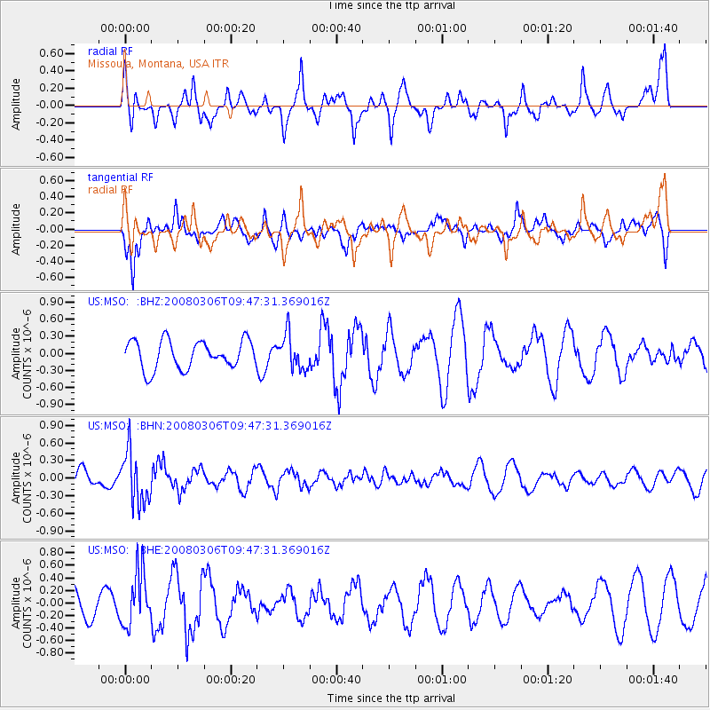
MSO Missoula, Montana, USA - Earthquake Result Viewer
*The percent match for this event was below the threshold and hence no stack was calculated.
| Earthquake location: |
Kamchatka Peninsula, Russia |
| Earthquake latitude/longitude: |
51.5/156.5 |
| Earthquake time(UTC): |
2008/03/06 (066) 09:38:43 GMT |
| Earthquake Depth: |
134 km |
| Earthquake Magnitude: |
5.6 MB, 5.5 MW, 5.5 MW |
| Earthquake Catalog/Contributor: |
WHDF/NEIC |
|
| Network: |
US United States National Seismic Network |
| Station: |
MSO Missoula, Montana, USA |
| Lat/Lon: |
46.83 N/113.94 W |
| Elevation: |
1264 m |
|
| Distance: |
55.2 deg |
| Az: |
56.778 deg |
| Baz: |
310.429 deg |
| Ray Param: |
$rayparam |
*The percent match for this event was below the threshold and hence was not used in the summary stack. |
|
| Radial Match: |
77.00219 % |
| Radial Bump: |
400 |
| Transverse Match: |
53.10818 % |
| Transverse Bump: |
400 |
| SOD ConfigId: |
2504 |
| Insert Time: |
2010-03-05 02:16:47.174 +0000 |
| GWidth: |
2.5 |
| Max Bumps: |
400 |
| Tol: |
0.001 |
|
Signal To Noise
| Channel | StoN | STA | LTA |
| US:MSO: :BHN:20080306T09:47:31.369016Z | 3.3836348 | 4.4363338E-7 | 1.3111149E-7 |
| US:MSO: :BHE:20080306T09:47:31.369016Z | 2.0610025 | 4.3341123E-7 | 2.1029147E-7 |
| US:MSO: :BHZ:20080306T09:47:31.369016Z | 1.253652 | 3.099665E-7 | 2.4725085E-7 |
| Arrivals |
| Ps | |
| PpPs | |
| PsPs/PpSs | |


