You are here: Home > Network List > US - United States National Seismic Network Stations List
> Station MSO Missoula, Montana, USA > Earthquake Result Viewer
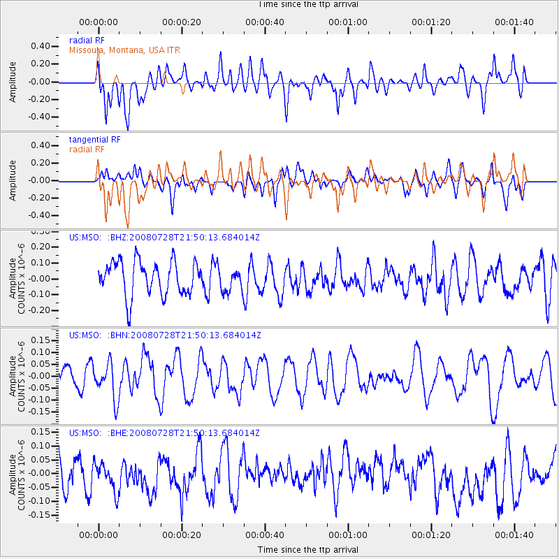
MSO Missoula, Montana, USA - Earthquake Result Viewer
*The percent match for this event was below the threshold and hence no stack was calculated.
| Earthquake location: |
Solomon Islands |
| Earthquake latitude/longitude: |
-10.6/163.2 |
| Earthquake time(UTC): |
2008/07/28 (210) 21:37:32 GMT |
| Earthquake Depth: |
10 km |
| Earthquake Magnitude: |
5.7 MB, 6.1 MS, 5.9 MW |
| Earthquake Catalog/Contributor: |
WHDF/NEIC |
|
| Network: |
US United States National Seismic Network |
| Station: |
MSO Missoula, Montana, USA |
| Lat/Lon: |
46.83 N/113.94 W |
| Elevation: |
1264 m |
|
| Distance: |
92.8 deg |
| Az: |
43.014 deg |
| Baz: |
257.632 deg |
| Ray Param: |
$rayparam |
*The percent match for this event was below the threshold and hence was not used in the summary stack. |
|
| Radial Match: |
51.96996 % |
| Radial Bump: |
400 |
| Transverse Match: |
38.671738 % |
| Transverse Bump: |
400 |
| SOD ConfigId: |
2658 |
| Insert Time: |
2010-03-05 02:16:58.664 +0000 |
| GWidth: |
2.5 |
| Max Bumps: |
400 |
| Tol: |
0.001 |
|
Signal To Noise
| Channel | StoN | STA | LTA |
| US:MSO: :BHN:20080728T21:50:13.684014Z | 1.8927042 | 7.752906E-8 | 4.0962057E-8 |
| US:MSO: :BHE:20080728T21:50:13.684014Z | 0.92481804 | 6.222615E-8 | 6.7284745E-8 |
| US:MSO: :BHZ:20080728T21:50:13.684014Z | 0.67996925 | 7.25377E-8 | 1.0667791E-7 |
| Arrivals |
| Ps | |
| PpPs | |
| PsPs/PpSs | |


