You are here: Home > Network List > TA - USArray Transportable Network (new EarthScope stations) Stations List
> Station G05D Wamic, OR, USA > Earthquake Result Viewer
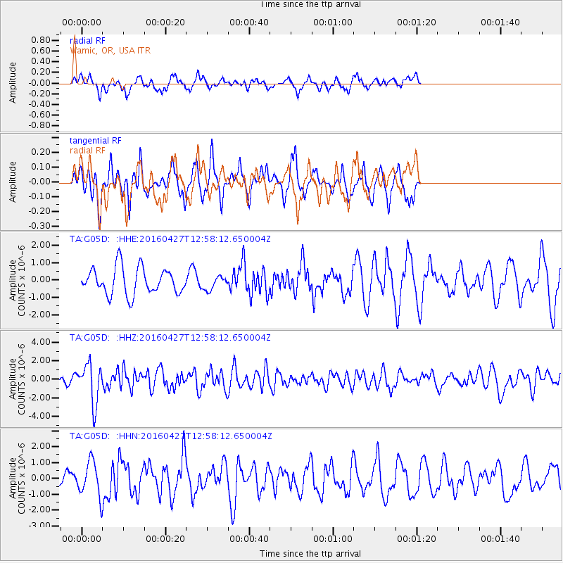
G05D Wamic, OR, USA - Earthquake Result Viewer
*The percent match for this event was below the threshold and hence no stack was calculated.
| Earthquake location: |
Near Coast Of Chiapas, Mexico |
| Earthquake latitude/longitude: |
14.6/-93.0 |
| Earthquake time(UTC): |
2016/04/27 (118) 12:51:22 GMT |
| Earthquake Depth: |
35 km |
| Earthquake Magnitude: |
5.8 MB |
| Earthquake Catalog/Contributor: |
NEIC PDE/NEIC COMCAT |
|
| Network: |
TA USArray Transportable Network (new EarthScope stations) |
| Station: |
G05D Wamic, OR, USA |
| Lat/Lon: |
45.24 N/121.32 W |
| Elevation: |
592 m |
|
| Distance: |
38.8 deg |
| Az: |
327.657 deg |
| Baz: |
132.845 deg |
| Ray Param: |
$rayparam |
*The percent match for this event was below the threshold and hence was not used in the summary stack. |
|
| Radial Match: |
52.981037 % |
| Radial Bump: |
400 |
| Transverse Match: |
63.990524 % |
| Transverse Bump: |
400 |
| SOD ConfigId: |
7422571 |
| Insert Time: |
2019-04-22 11:30:25.376 +0000 |
| GWidth: |
2.5 |
| Max Bumps: |
400 |
| Tol: |
0.001 |
|
Signal To Noise
| Channel | StoN | STA | LTA |
| TA:G05D: :HHZ:20160427T12:58:12.650004Z | 3.7693193 | 2.1644782E-6 | 5.7423586E-7 |
| TA:G05D: :HHN:20160427T12:58:12.650004Z | 1.2255917 | 1.1028105E-6 | 8.9981893E-7 |
| TA:G05D: :HHE:20160427T12:58:12.650004Z | 0.46789163 | 3.6724776E-7 | 7.8489916E-7 |
| Arrivals |
| Ps | |
| PpPs | |
| PsPs/PpSs | |


