You are here: Home > Network List > US - United States National Seismic Network Stations List
> Station MSO Missoula, Montana, USA > Earthquake Result Viewer
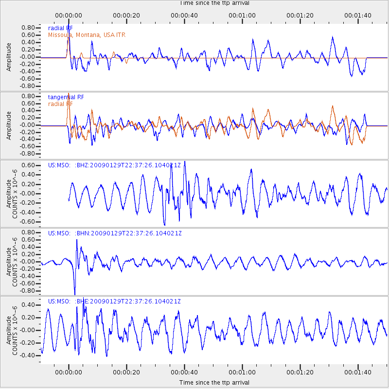
MSO Missoula, Montana, USA - Earthquake Result Viewer
*The percent match for this event was below the threshold and hence no stack was calculated.
| Earthquake location: |
Western Brazil |
| Earthquake latitude/longitude: |
-8.1/-71.4 |
| Earthquake time(UTC): |
2009/01/29 (029) 22:28:05 GMT |
| Earthquake Depth: |
602 km |
| Earthquake Magnitude: |
5.7 MW, 5.3 MB, 5.6 MW |
| Earthquake Catalog/Contributor: |
WHDF/NEIC |
|
| Network: |
US United States National Seismic Network |
| Station: |
MSO Missoula, Montana, USA |
| Lat/Lon: |
46.83 N/113.94 W |
| Elevation: |
1264 m |
|
| Distance: |
66.5 deg |
| Az: |
329.584 deg |
| Baz: |
133.108 deg |
| Ray Param: |
$rayparam |
*The percent match for this event was below the threshold and hence was not used in the summary stack. |
|
| Radial Match: |
56.44572 % |
| Radial Bump: |
400 |
| Transverse Match: |
54.041183 % |
| Transverse Bump: |
400 |
| SOD ConfigId: |
2658 |
| Insert Time: |
2010-03-05 02:17:01.515 +0000 |
| GWidth: |
2.5 |
| Max Bumps: |
400 |
| Tol: |
0.001 |
|
Signal To Noise
| Channel | StoN | STA | LTA |
| US:MSO: :BHN:20090129T22:37:26.104021Z | 5.8260665 | 3.2255133E-7 | 5.5363486E-8 |
| US:MSO: :BHE:20090129T22:37:26.104021Z | 1.1030205 | 1.9197796E-7 | 1.740475E-7 |
| US:MSO: :BHZ:20090129T22:37:26.104021Z | 1.5688082 | 2.8927104E-7 | 1.8438905E-7 |
| Arrivals |
| Ps | |
| PpPs | |
| PsPs/PpSs | |


