You are here: Home > Network List > US - United States National Seismic Network Stations List
> Station MSO Missoula, Montana, USA > Earthquake Result Viewer
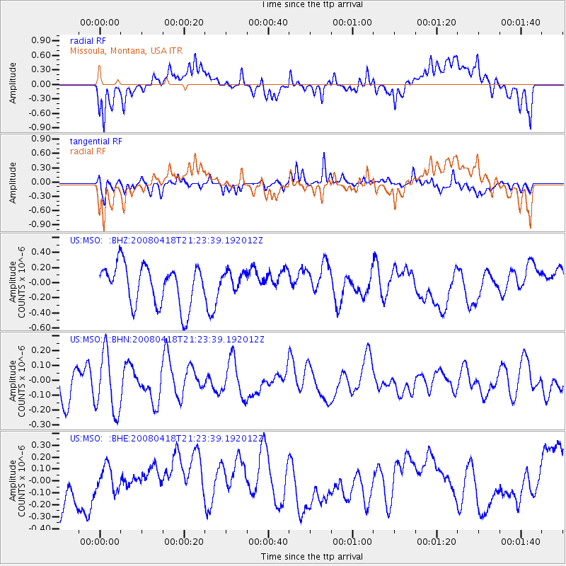
MSO Missoula, Montana, USA - Earthquake Result Viewer
*The percent match for this event was below the threshold and hence no stack was calculated.
| Earthquake location: |
Kermadec Islands Region |
| Earthquake latitude/longitude: |
-27.5/-176.6 |
| Earthquake time(UTC): |
2008/04/18 (109) 21:10:56 GMT |
| Earthquake Depth: |
10 km |
| Earthquake Magnitude: |
5.6 MS, 5.4 MB, 5.8 MW, 5.8 MW |
| Earthquake Catalog/Contributor: |
WHDF/NEIC |
|
| Network: |
US United States National Seismic Network |
| Station: |
MSO Missoula, Montana, USA |
| Lat/Lon: |
46.83 N/113.94 W |
| Elevation: |
1264 m |
|
| Distance: |
93.1 deg |
| Az: |
37.64 deg |
| Baz: |
232.172 deg |
| Ray Param: |
$rayparam |
*The percent match for this event was below the threshold and hence was not used in the summary stack. |
|
| Radial Match: |
49.617718 % |
| Radial Bump: |
400 |
| Transverse Match: |
60.480595 % |
| Transverse Bump: |
400 |
| SOD ConfigId: |
2504 |
| Insert Time: |
2010-03-05 02:17:05.723 +0000 |
| GWidth: |
2.5 |
| Max Bumps: |
400 |
| Tol: |
0.001 |
|
Signal To Noise
| Channel | StoN | STA | LTA |
| US:MSO: :BHN:20080418T21:23:39.192012Z | 1.8322124 | 2.0367422E-7 | 1.1116299E-7 |
| US:MSO: :BHE:20080418T21:23:39.192012Z | 0.614257 | 1.08817964E-7 | 1.7715381E-7 |
| US:MSO: :BHZ:20080418T21:23:39.192012Z | 0.5025174 | 1.348105E-7 | 2.6827036E-7 |
| Arrivals |
| Ps | |
| PpPs | |
| PsPs/PpSs | |


