You are here: Home > Network List > UW - Pacific Northwest Regional Seismic Network Stations List
> Station LEBA Lebam, WA, USA > Earthquake Result Viewer
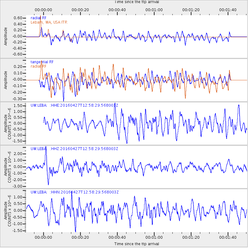
LEBA Lebam, WA, USA - Earthquake Result Viewer
*The percent match for this event was below the threshold and hence no stack was calculated.
| Earthquake location: |
Near Coast Of Chiapas, Mexico |
| Earthquake latitude/longitude: |
14.6/-93.0 |
| Earthquake time(UTC): |
2016/04/27 (118) 12:51:22 GMT |
| Earthquake Depth: |
35 km |
| Earthquake Magnitude: |
5.8 MB |
| Earthquake Catalog/Contributor: |
NEIC PDE/NEIC COMCAT |
|
| Network: |
UW Pacific Northwest Regional Seismic Network |
| Station: |
LEBA Lebam, WA, USA |
| Lat/Lon: |
46.55 N/123.56 W |
| Elevation: |
73 m |
|
| Distance: |
40.9 deg |
| Az: |
327.531 deg |
| Baz: |
131.14 deg |
| Ray Param: |
$rayparam |
*The percent match for this event was below the threshold and hence was not used in the summary stack. |
|
| Radial Match: |
57.169727 % |
| Radial Bump: |
400 |
| Transverse Match: |
50.75179 % |
| Transverse Bump: |
400 |
| SOD ConfigId: |
7422571 |
| Insert Time: |
2019-04-22 11:31:40.355 +0000 |
| GWidth: |
2.5 |
| Max Bumps: |
400 |
| Tol: |
0.001 |
|
Signal To Noise
| Channel | StoN | STA | LTA |
| UW:LEBA: :HHZ:20160427T12:58:29.568003Z | 7.4437385 | 1.386225E-6 | 1.8622698E-7 |
| UW:LEBA: :HHN:20160427T12:58:29.568003Z | 1.2257497 | 5.49761E-7 | 4.4851004E-7 |
| UW:LEBA: :HHE:20160427T12:58:29.568003Z | 1.4155661 | 4.81076E-7 | 3.3984705E-7 |
| Arrivals |
| Ps | |
| PpPs | |
| PsPs/PpSs | |


