You are here: Home > Network List > UW - Pacific Northwest Regional Seismic Network Stations List
> Station PASS Maple Falls, WA, USA > Earthquake Result Viewer
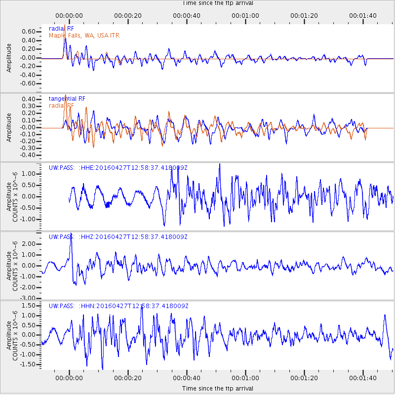
PASS Maple Falls, WA, USA - Earthquake Result Viewer
*The percent match for this event was below the threshold and hence no stack was calculated.
| Earthquake location: |
Near Coast Of Chiapas, Mexico |
| Earthquake latitude/longitude: |
14.6/-93.0 |
| Earthquake time(UTC): |
2016/04/27 (118) 12:51:22 GMT |
| Earthquake Depth: |
35 km |
| Earthquake Magnitude: |
5.8 MB |
| Earthquake Catalog/Contributor: |
NEIC PDE/NEIC COMCAT |
|
| Network: |
UW Pacific Northwest Regional Seismic Network |
| Station: |
PASS Maple Falls, WA, USA |
| Lat/Lon: |
49.00 N/122.09 W |
| Elevation: |
174 m |
|
| Distance: |
41.8 deg |
| Az: |
331.275 deg |
| Baz: |
135.043 deg |
| Ray Param: |
$rayparam |
*The percent match for this event was below the threshold and hence was not used in the summary stack. |
|
| Radial Match: |
72.14476 % |
| Radial Bump: |
400 |
| Transverse Match: |
65.1716 % |
| Transverse Bump: |
400 |
| SOD ConfigId: |
7422571 |
| Insert Time: |
2019-04-22 11:31:42.922 +0000 |
| GWidth: |
2.5 |
| Max Bumps: |
400 |
| Tol: |
0.001 |
|
Signal To Noise
| Channel | StoN | STA | LTA |
| UW:PASS: :HHZ:20160427T12:58:37.418009Z | 4.5886827 | 1.262891E-6 | 2.7521864E-7 |
| UW:PASS: :HHN:20160427T12:58:37.418009Z | 1.3864131 | 4.5042506E-7 | 3.2488518E-7 |
| UW:PASS: :HHE:20160427T12:58:37.418009Z | 2.2100883 | 6.213304E-7 | 2.8113377E-7 |
| Arrivals |
| Ps | |
| PpPs | |
| PsPs/PpSs | |


