You are here: Home > Network List > US - United States National Seismic Network Stations List
> Station MSO Missoula, Montana, USA > Earthquake Result Viewer
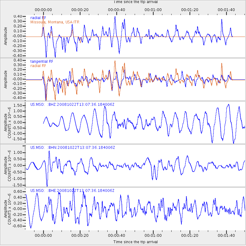
MSO Missoula, Montana, USA - Earthquake Result Viewer
*The percent match for this event was below the threshold and hence no stack was calculated.
| Earthquake location: |
Tonga Islands |
| Earthquake latitude/longitude: |
-18.4/-175.4 |
| Earthquake time(UTC): |
2008/10/22 (296) 12:55:57 GMT |
| Earthquake Depth: |
233 km |
| Earthquake Magnitude: |
5.9 MB, 6.4 MW, 6.3 MW |
| Earthquake Catalog/Contributor: |
WHDF/NEIC |
|
| Network: |
US United States National Seismic Network |
| Station: |
MSO Missoula, Montana, USA |
| Lat/Lon: |
46.83 N/113.94 W |
| Elevation: |
1264 m |
|
| Distance: |
85.2 deg |
| Az: |
37.23 deg |
| Baz: |
236.783 deg |
| Ray Param: |
$rayparam |
*The percent match for this event was below the threshold and hence was not used in the summary stack. |
|
| Radial Match: |
37.039455 % |
| Radial Bump: |
278 |
| Transverse Match: |
30.964996 % |
| Transverse Bump: |
291 |
| SOD ConfigId: |
2560 |
| Insert Time: |
2010-03-05 02:18:22.752 +0000 |
| GWidth: |
2.5 |
| Max Bumps: |
400 |
| Tol: |
0.001 |
|
Signal To Noise
| Channel | StoN | STA | LTA |
| US:MSO: :BHN:20081022T13:07:36.184006Z | 3.5346267 | 6.5828726E-7 | 1.8623953E-7 |
| US:MSO: :BHE:20081022T13:07:36.184006Z | 0.69294524 | 2.3582464E-7 | 3.403222E-7 |
| US:MSO: :BHZ:20081022T13:07:36.184006Z | 2.0545971 | 9.280517E-7 | 4.5169523E-7 |
| Arrivals |
| Ps | |
| PpPs | |
| PsPs/PpSs | |


