You are here: Home > Network List > US - United States National Seismic Network Stations List
> Station MSO Missoula, Montana, USA > Earthquake Result Viewer
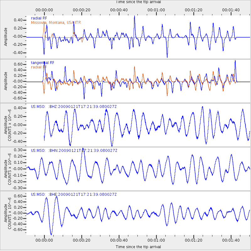
MSO Missoula, Montana, USA - Earthquake Result Viewer
*The percent match for this event was below the threshold and hence no stack was calculated.
| Earthquake location: |
Southeast Of Loyalty Islands |
| Earthquake latitude/longitude: |
-22.7/171.0 |
| Earthquake time(UTC): |
2009/01/21 (021) 17:08:42 GMT |
| Earthquake Depth: |
24 km |
| Earthquake Magnitude: |
5.8 MS, 5.4 MB, 6.1 MW, 6.1 MW |
| Earthquake Catalog/Contributor: |
WHDF/NEIC |
|
| Network: |
US United States National Seismic Network |
| Station: |
MSO Missoula, Montana, USA |
| Lat/Lon: |
46.83 N/113.94 W |
| Elevation: |
1264 m |
|
| Distance: |
96.6 deg |
| Az: |
41.889 deg |
| Baz: |
243.906 deg |
| Ray Param: |
$rayparam |
*The percent match for this event was below the threshold and hence was not used in the summary stack. |
|
| Radial Match: |
46.25205 % |
| Radial Bump: |
400 |
| Transverse Match: |
40.190243 % |
| Transverse Bump: |
309 |
| SOD ConfigId: |
2834 |
| Insert Time: |
2010-03-05 02:18:25.291 +0000 |
| GWidth: |
2.5 |
| Max Bumps: |
400 |
| Tol: |
0.001 |
|
Signal To Noise
| Channel | StoN | STA | LTA |
| US:MSO: :BHN:20090121T17:21:39.080027Z | 0.847391 | 8.355902E-8 | 9.8607394E-8 |
| US:MSO: :BHE:20090121T17:21:39.080027Z | 2.1965942 | 4.526432E-7 | 2.060659E-7 |
| US:MSO: :BHZ:20090121T17:21:39.080027Z | 1.0626879 | 2.0139221E-7 | 1.895121E-7 |
| Arrivals |
| Ps | |
| PpPs | |
| PsPs/PpSs | |


