You are here: Home > Network List > US - United States National Seismic Network Stations List
> Station MSO Missoula, Montana, USA > Earthquake Result Viewer
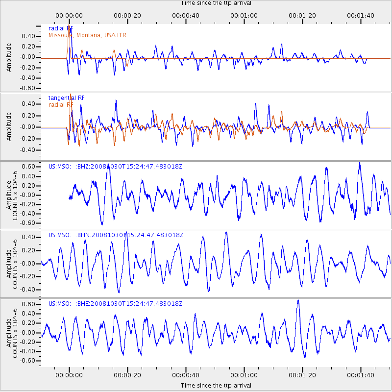
MSO Missoula, Montana, USA - Earthquake Result Viewer
*The percent match for this event was below the threshold and hence no stack was calculated.
| Earthquake location: |
Central East Pacific Rise |
| Earthquake latitude/longitude: |
-9.0/-108.2 |
| Earthquake time(UTC): |
2008/10/30 (304) 15:15:41 GMT |
| Earthquake Depth: |
10 km |
| Earthquake Magnitude: |
5.5 MB, 5.8 MS, 6.0 MW, 6.0 MW |
| Earthquake Catalog/Contributor: |
WHDF/NEIC |
|
| Network: |
US United States National Seismic Network |
| Station: |
MSO Missoula, Montana, USA |
| Lat/Lon: |
46.83 N/113.94 W |
| Elevation: |
1264 m |
|
| Distance: |
55.8 deg |
| Az: |
355.277 deg |
| Baz: |
173.196 deg |
| Ray Param: |
$rayparam |
*The percent match for this event was below the threshold and hence was not used in the summary stack. |
|
| Radial Match: |
57.701385 % |
| Radial Bump: |
400 |
| Transverse Match: |
69.4248 % |
| Transverse Bump: |
400 |
| SOD ConfigId: |
2560 |
| Insert Time: |
2010-03-05 02:18:28.606 +0000 |
| GWidth: |
2.5 |
| Max Bumps: |
400 |
| Tol: |
0.001 |
|
Signal To Noise
| Channel | StoN | STA | LTA |
| US:MSO: :BHN:20081030T15:24:47.483018Z | 1.7483335 | 2.0960925E-7 | 1.1989088E-7 |
| US:MSO: :BHE:20081030T15:24:47.483018Z | 1.9578311 | 2.7017646E-7 | 1.3799783E-7 |
| US:MSO: :BHZ:20081030T15:24:47.483018Z | 0.41621447 | 1.05867905E-7 | 2.5435904E-7 |
| Arrivals |
| Ps | |
| PpPs | |
| PsPs/PpSs | |


