You are here: Home > Network List > US - United States National Seismic Network Stations List
> Station MSO Missoula, Montana, USA > Earthquake Result Viewer
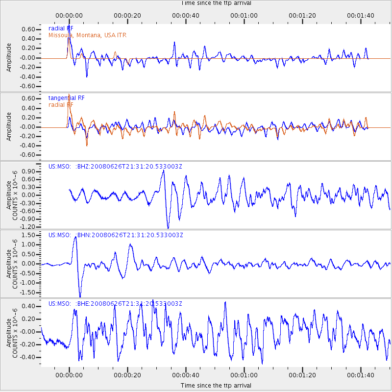
MSO Missoula, Montana, USA - Earthquake Result Viewer
*The percent match for this event was below the threshold and hence no stack was calculated.
| Earthquake location: |
Tonga Islands |
| Earthquake latitude/longitude: |
-20.8/-173.3 |
| Earthquake time(UTC): |
2008/06/26 (178) 21:19:15 GMT |
| Earthquake Depth: |
38 km |
| Earthquake Magnitude: |
6.0 MB, 5.8 MS, 6.2 MW, 6.1 MW |
| Earthquake Catalog/Contributor: |
WHDF/NEIC |
|
| Network: |
US United States National Seismic Network |
| Station: |
MSO Missoula, Montana, USA |
| Lat/Lon: |
46.83 N/113.94 W |
| Elevation: |
1264 m |
|
| Distance: |
85.9 deg |
| Az: |
36.334 deg |
| Baz: |
233.855 deg |
| Ray Param: |
$rayparam |
*The percent match for this event was below the threshold and hence was not used in the summary stack. |
|
| Radial Match: |
79.75809 % |
| Radial Bump: |
400 |
| Transverse Match: |
66.3247 % |
| Transverse Bump: |
400 |
| SOD ConfigId: |
2504 |
| Insert Time: |
2010-03-05 02:18:34.639 +0000 |
| GWidth: |
2.5 |
| Max Bumps: |
400 |
| Tol: |
0.001 |
|
Signal To Noise
| Channel | StoN | STA | LTA |
| US:MSO: :BHN:20080626T21:31:20.533003Z | 12.712497 | 9.0718817E-7 | 7.136192E-8 |
| US:MSO: :BHE:20080626T21:31:20.533003Z | 2.0434275 | 2.654611E-7 | 1.2990974E-7 |
| US:MSO: :BHZ:20080626T21:31:20.533003Z | 4.9603357 | 6.3119387E-7 | 1.2724821E-7 |
| Arrivals |
| Ps | |
| PpPs | |
| PsPs/PpSs | |


