You are here: Home > Network List > US - United States National Seismic Network Stations List
> Station MSO Missoula, Montana, USA > Earthquake Result Viewer
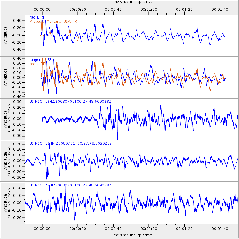
MSO Missoula, Montana, USA - Earthquake Result Viewer
*The percent match for this event was below the threshold and hence no stack was calculated.
| Earthquake location: |
Central Peru |
| Earthquake latitude/longitude: |
-10.4/-75.5 |
| Earthquake time(UTC): |
2008/07/01 (183) 00:17:33 GMT |
| Earthquake Depth: |
33 km |
| Earthquake Magnitude: |
5.5 MW, 5.0 MS, 5.4 MB, 5.3 ML |
| Earthquake Catalog/Contributor: |
WHDF/NEIC |
|
| Network: |
US United States National Seismic Network |
| Station: |
MSO Missoula, Montana, USA |
| Lat/Lon: |
46.83 N/113.94 W |
| Elevation: |
1264 m |
|
| Distance: |
66.5 deg |
| Az: |
332.26 deg |
| Baz: |
138.166 deg |
| Ray Param: |
$rayparam |
*The percent match for this event was below the threshold and hence was not used in the summary stack. |
|
| Radial Match: |
52.703922 % |
| Radial Bump: |
400 |
| Transverse Match: |
59.80855 % |
| Transverse Bump: |
400 |
| SOD ConfigId: |
2504 |
| Insert Time: |
2010-03-05 02:18:35.236 +0000 |
| GWidth: |
2.5 |
| Max Bumps: |
400 |
| Tol: |
0.001 |
|
Signal To Noise
| Channel | StoN | STA | LTA |
| US:MSO: :BHN:20080701T00:27:48.609028Z | 4.234691 | 1.5362309E-7 | 3.6277285E-8 |
| US:MSO: :BHE:20080701T00:27:48.609028Z | 1.339919 | 8.356341E-8 | 6.236452E-8 |
| US:MSO: :BHZ:20080701T00:27:48.609028Z | 2.7614791 | 8.542863E-8 | 3.0935823E-8 |
| Arrivals |
| Ps | |
| PpPs | |
| PsPs/PpSs | |


