You are here: Home > Network List > US - United States National Seismic Network Stations List
> Station MSO Missoula, Montana, USA > Earthquake Result Viewer
MSO Missoula, Montana, USA - Earthquake Result Viewer
*The percent match for this event was below the threshold and hence no stack was calculated.
| Earthquake location: |
Loyalty Islands |
| Earthquake latitude/longitude: |
-20.2/168.8 |
| Earthquake time(UTC): |
2008/04/28 (119) 20:26:53 GMT |
| Earthquake Depth: |
35 km |
| Earthquake Magnitude: |
5.8 MB, 5.7 MS, 6.1 MW, 6.0 MW |
| Earthquake Catalog/Contributor: |
WHDF/NEIC |
|
| Network: |
US United States National Seismic Network |
| Station: |
MSO Missoula, Montana, USA |
| Lat/Lon: |
46.83 N/113.94 W |
| Elevation: |
1264 m |
|
| Distance: |
96.2 deg |
| Az: |
42.342 deg |
| Baz: |
247.095 deg |
| Ray Param: |
$rayparam |
*The percent match for this event was below the threshold and hence was not used in the summary stack. |
|
| Radial Match: |
57.6585 % |
| Radial Bump: |
400 |
| Transverse Match: |
60.716816 % |
| Transverse Bump: |
324 |
| SOD ConfigId: |
2504 |
| Insert Time: |
2010-03-05 02:18:40.288 +0000 |
| GWidth: |
2.5 |
| Max Bumps: |
400 |
| Tol: |
0.001 |
|
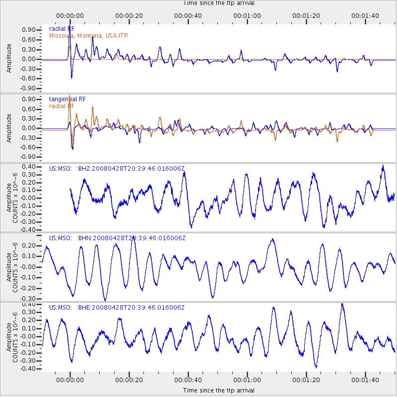
Signal To Noise
| Channel | StoN | STA | LTA |
| US:MSO: :BHN:20080428T20:39:46.016006Z | 2.0079894 | 1.9030789E-7 | 9.477534E-8 |
| US:MSO: :BHE:20080428T20:39:46.016006Z | 1.2956916 | 1.6247691E-7 | 1.2539782E-7 |
| US:MSO: :BHZ:20080428T20:39:46.016006Z | 1.3135743 | 1.4116279E-7 | 1.07464636E-7 |
| Arrivals |
| Ps | |
| PpPs | |
| PsPs/PpSs | |


