You are here: Home > Network List > US - United States National Seismic Network Stations List
> Station MSO Missoula, Montana, USA > Earthquake Result Viewer
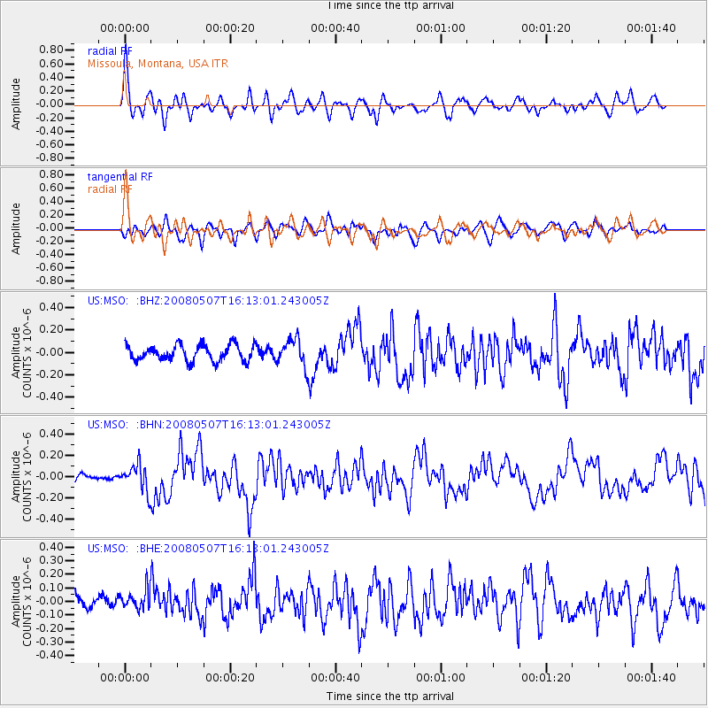
MSO Missoula, Montana, USA - Earthquake Result Viewer
*The percent match for this event was below the threshold and hence no stack was calculated.
| Earthquake location: |
Near East Coast Of Honshu, Japan |
| Earthquake latitude/longitude: |
36.2/141.5 |
| Earthquake time(UTC): |
2008/05/07 (128) 16:02:02 GMT |
| Earthquake Depth: |
19 km |
| Earthquake Magnitude: |
5.7 MB, 6.2 MW, 6.2 MW |
| Earthquake Catalog/Contributor: |
WHDF/NEIC |
|
| Network: |
US United States National Seismic Network |
| Station: |
MSO Missoula, Montana, USA |
| Lat/Lon: |
46.83 N/113.94 W |
| Elevation: |
1264 m |
|
| Distance: |
73.3 deg |
| Az: |
43.957 deg |
| Baz: |
305.123 deg |
| Ray Param: |
$rayparam |
*The percent match for this event was below the threshold and hence was not used in the summary stack. |
|
| Radial Match: |
75.880264 % |
| Radial Bump: |
400 |
| Transverse Match: |
60.74309 % |
| Transverse Bump: |
400 |
| SOD ConfigId: |
2504 |
| Insert Time: |
2010-03-05 02:18:42.153 +0000 |
| GWidth: |
2.5 |
| Max Bumps: |
400 |
| Tol: |
0.001 |
|
Signal To Noise
| Channel | StoN | STA | LTA |
| US:MSO: :BHN:20080507T16:13:01.243005Z | 3.2845778 | 1.2773107E-7 | 3.8888125E-8 |
| US:MSO: :BHE:20080507T16:13:01.243005Z | 1.3985647 | 7.6453574E-8 | 5.466574E-8 |
| US:MSO: :BHZ:20080507T16:13:01.243005Z | 1.7270746 | 1.2305041E-7 | 7.124788E-8 |
| Arrivals |
| Ps | |
| PpPs | |
| PsPs/PpSs | |


