You are here: Home > Network List > US - United States National Seismic Network Stations List
> Station MSO Missoula, Montana, USA > Earthquake Result Viewer
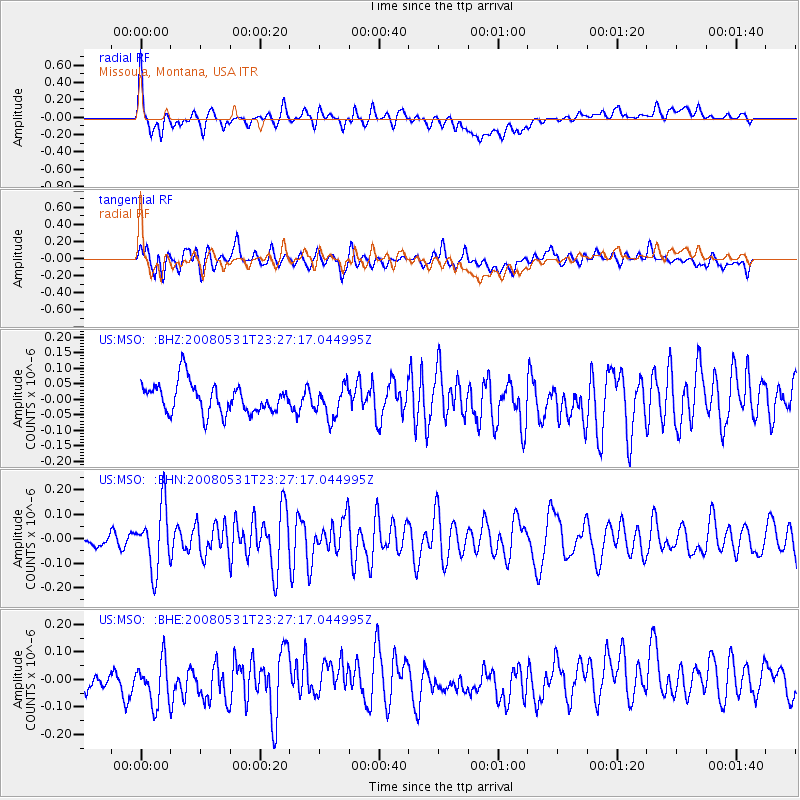
MSO Missoula, Montana, USA - Earthquake Result Viewer
*The percent match for this event was below the threshold and hence no stack was calculated.
| Earthquake location: |
Easter Island Region |
| Earthquake latitude/longitude: |
-28.9/-112.3 |
| Earthquake time(UTC): |
2008/05/31 (152) 23:16:04 GMT |
| Earthquake Depth: |
10 km |
| Earthquake Magnitude: |
5.5 MS, 5.4 MB, 5.8 MW, 5.8 MW |
| Earthquake Catalog/Contributor: |
WHDF/NEIC |
|
| Network: |
US United States National Seismic Network |
| Station: |
MSO Missoula, Montana, USA |
| Lat/Lon: |
46.83 N/113.94 W |
| Elevation: |
1264 m |
|
| Distance: |
75.4 deg |
| Az: |
358.806 deg |
| Baz: |
178.476 deg |
| Ray Param: |
$rayparam |
*The percent match for this event was below the threshold and hence was not used in the summary stack. |
|
| Radial Match: |
70.85857 % |
| Radial Bump: |
400 |
| Transverse Match: |
67.45827 % |
| Transverse Bump: |
400 |
| SOD ConfigId: |
2504 |
| Insert Time: |
2010-03-05 02:18:48.800 +0000 |
| GWidth: |
2.5 |
| Max Bumps: |
400 |
| Tol: |
0.001 |
|
Signal To Noise
| Channel | StoN | STA | LTA |
| US:MSO: :BHN:20080531T23:27:17.044995Z | 6.9859123 | 1.2757317E-7 | 1.826149E-8 |
| US:MSO: :BHE:20080531T23:27:17.044995Z | 2.2119691 | 8.932533E-8 | 4.0382723E-8 |
| US:MSO: :BHZ:20080531T23:27:17.044995Z | 1.0398356 | 5.0688516E-8 | 4.8746664E-8 |
| Arrivals |
| Ps | |
| PpPs | |
| PsPs/PpSs | |


