You are here: Home > Network List > US - United States National Seismic Network Stations List
> Station MSO Missoula, Montana, USA > Earthquake Result Viewer
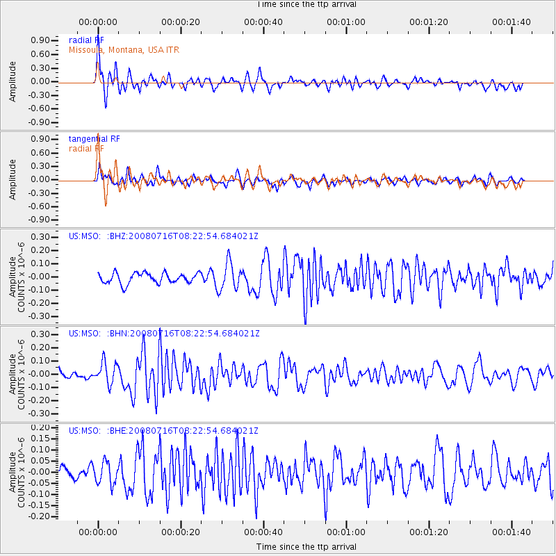
MSO Missoula, Montana, USA - Earthquake Result Viewer
*The percent match for this event was below the threshold and hence no stack was calculated.
| Earthquake location: |
Samoa Islands Region |
| Earthquake latitude/longitude: |
-16.6/-173.0 |
| Earthquake time(UTC): |
2008/07/16 (198) 08:11:04 GMT |
| Earthquake Depth: |
10 km |
| Earthquake Magnitude: |
5.5 MB, 5.4 MS, 5.7 MW, 5.7 MW |
| Earthquake Catalog/Contributor: |
WHDF/NEIC |
|
| Network: |
US United States National Seismic Network |
| Station: |
MSO Missoula, Montana, USA |
| Lat/Lon: |
46.83 N/113.94 W |
| Elevation: |
1264 m |
|
| Distance: |
82.4 deg |
| Az: |
36.435 deg |
| Baz: |
236.037 deg |
| Ray Param: |
$rayparam |
*The percent match for this event was below the threshold and hence was not used in the summary stack. |
|
| Radial Match: |
75.0324 % |
| Radial Bump: |
400 |
| Transverse Match: |
67.40731 % |
| Transverse Bump: |
400 |
| SOD ConfigId: |
2504 |
| Insert Time: |
2010-03-05 02:19:18.382 +0000 |
| GWidth: |
2.5 |
| Max Bumps: |
400 |
| Tol: |
0.001 |
|
Signal To Noise
| Channel | StoN | STA | LTA |
| US:MSO: :BHN:20080716T08:22:54.684021Z | 3.1262715 | 8.290533E-8 | 2.6518915E-8 |
| US:MSO: :BHE:20080716T08:22:54.684021Z | 1.5573918 | 4.882517E-8 | 3.1350602E-8 |
| US:MSO: :BHZ:20080716T08:22:54.684021Z | 2.6410317 | 1.0516035E-7 | 3.9817905E-8 |
| Arrivals |
| Ps | |
| PpPs | |
| PsPs/PpSs | |


