You are here: Home > Network List > US - United States National Seismic Network Stations List
> Station MSO Missoula, Montana, USA > Earthquake Result Viewer
MSO Missoula, Montana, USA - Earthquake Result Viewer
*The percent match for this event was below the threshold and hence no stack was calculated.
| Earthquake location: |
Easter Island Region |
| Earthquake latitude/longitude: |
-28.5/-112.8 |
| Earthquake time(UTC): |
2008/08/19 (232) 10:58:00 GMT |
| Earthquake Depth: |
9.0 km |
| Earthquake Magnitude: |
5.5 MB, 5.3 MS, 5.7 MW, 5.7 MW |
| Earthquake Catalog/Contributor: |
WHDF/NEIC |
|
| Network: |
US United States National Seismic Network |
| Station: |
MSO Missoula, Montana, USA |
| Lat/Lon: |
46.83 N/113.94 W |
| Elevation: |
1264 m |
|
| Distance: |
75.0 deg |
| Az: |
359.219 deg |
| Baz: |
179.0 deg |
| Ray Param: |
$rayparam |
*The percent match for this event was below the threshold and hence was not used in the summary stack. |
|
| Radial Match: |
57.758644 % |
| Radial Bump: |
292 |
| Transverse Match: |
64.479454 % |
| Transverse Bump: |
400 |
| SOD ConfigId: |
2504 |
| Insert Time: |
2010-03-05 02:19:35.872 +0000 |
| GWidth: |
2.5 |
| Max Bumps: |
400 |
| Tol: |
0.001 |
|
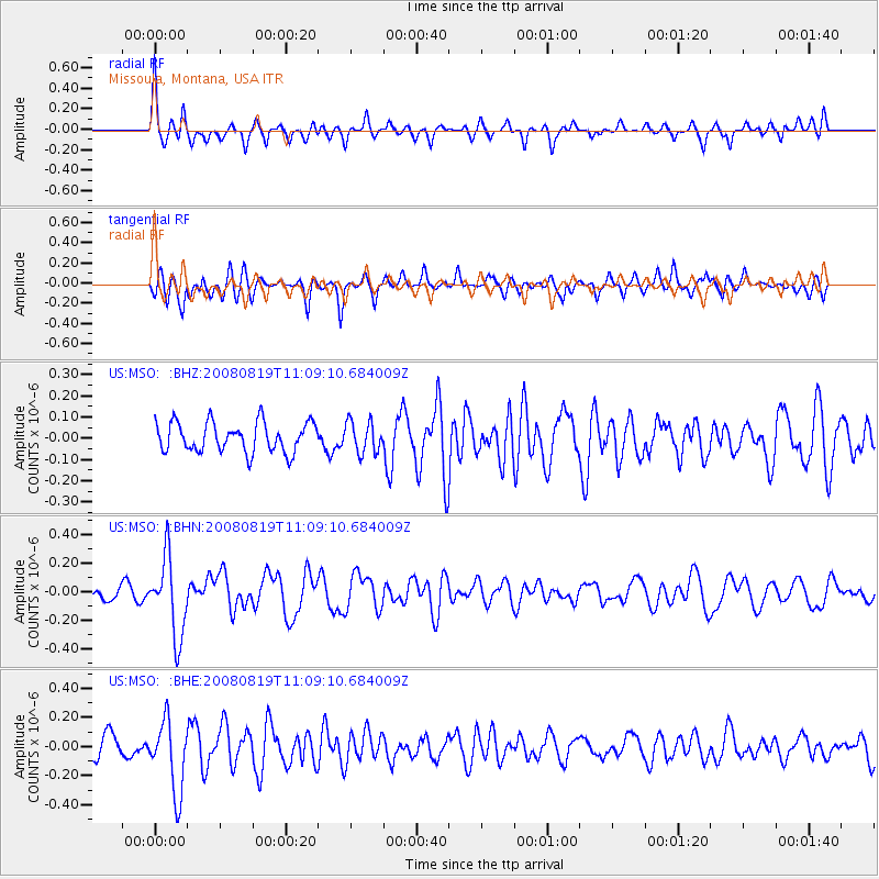
Signal To Noise
| Channel | StoN | STA | LTA |
| US:MSO: :BHN:20080819T11:09:10.684009Z | 4.5358944 | 2.7325714E-7 | 6.024327E-8 |
| US:MSO: :BHE:20080819T11:09:10.684009Z | 3.132239 | 2.5036883E-7 | 7.993286E-8 |
| US:MSO: :BHZ:20080819T11:09:10.684009Z | 1.0597422 | 7.4247296E-8 | 7.006166E-8 |
| Arrivals |
| Ps | |
| PpPs | |
| PsPs/PpSs | |


