You are here: Home > Network List > US - United States National Seismic Network Stations List
> Station MSO Missoula, Montana, USA > Earthquake Result Viewer
MSO Missoula, Montana, USA - Earthquake Result Viewer
*The percent match for this event was below the threshold and hence no stack was calculated.
| Earthquake location: |
Panama-Costa Rica Border Region |
| Earthquake latitude/longitude: |
8.3/-83.0 |
| Earthquake time(UTC): |
2008/11/19 (324) 06:11:20 GMT |
| Earthquake Depth: |
32 km |
| Earthquake Magnitude: |
5.9 MB, 5.9 MS, 6.2 MW, 6.1 MW |
| Earthquake Catalog/Contributor: |
WHDF/NEIC |
|
| Network: |
US United States National Seismic Network |
| Station: |
MSO Missoula, Montana, USA |
| Lat/Lon: |
46.83 N/113.94 W |
| Elevation: |
1264 m |
|
| Distance: |
46.6 deg |
| Az: |
330.923 deg |
| Baz: |
135.53 deg |
| Ray Param: |
$rayparam |
*The percent match for this event was below the threshold and hence was not used in the summary stack. |
|
| Radial Match: |
65.82452 % |
| Radial Bump: |
394 |
| Transverse Match: |
65.64864 % |
| Transverse Bump: |
400 |
| SOD ConfigId: |
2658 |
| Insert Time: |
2010-03-05 02:19:47.636 +0000 |
| GWidth: |
2.5 |
| Max Bumps: |
400 |
| Tol: |
0.001 |
|
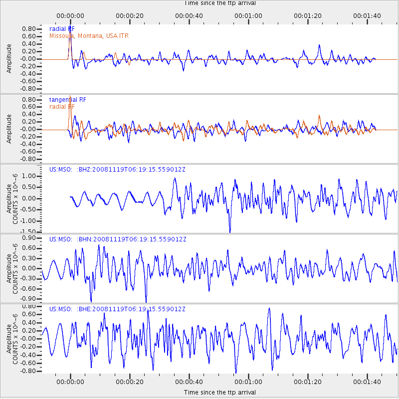
Signal To Noise
| Channel | StoN | STA | LTA |
| US:MSO: :BHN:20081119T06:19:15.559012Z | 2.2778068 | 2.954827E-7 | 1.2972247E-7 |
| US:MSO: :BHE:20081119T06:19:15.559012Z | 1.3156295 | 2.1862006E-7 | 1.6617146E-7 |
| US:MSO: :BHZ:20081119T06:19:15.559012Z | 1.8285196 | 3.6133363E-7 | 1.9760994E-7 |
| Arrivals |
| Ps | |
| PpPs | |
| PsPs/PpSs | |


