You are here: Home > Network List > US - United States National Seismic Network Stations List
> Station MSO Missoula, Montana, USA > Earthquake Result Viewer
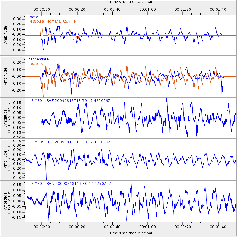
MSO Missoula, Montana, USA - Earthquake Result Viewer
*The percent match for this event was below the threshold and hence no stack was calculated.
| Earthquake location: |
Southwestern Ryukyu Isl., Japan |
| Earthquake latitude/longitude: |
23.5/123.5 |
| Earthquake time(UTC): |
2009/08/18 (230) 13:17:35 GMT |
| Earthquake Depth: |
5.7 km |
| Earthquake Magnitude: |
5.6 MB, 5.2 MS |
| Earthquake Catalog/Contributor: |
WHDF/NEIC |
|
| Network: |
US United States National Seismic Network |
| Station: |
MSO Missoula, Montana, USA |
| Lat/Lon: |
46.83 N/113.94 W |
| Elevation: |
1264 m |
|
| Distance: |
92.9 deg |
| Az: |
35.419 deg |
| Baz: |
309.211 deg |
| Ray Param: |
$rayparam |
*The percent match for this event was below the threshold and hence was not used in the summary stack. |
|
| Radial Match: |
60.52373 % |
| Radial Bump: |
400 |
| Transverse Match: |
61.185276 % |
| Transverse Bump: |
400 |
| SOD ConfigId: |
2622 |
| Insert Time: |
2010-03-05 02:19:55.750 +0000 |
| GWidth: |
2.5 |
| Max Bumps: |
400 |
| Tol: |
0.001 |
|
Signal To Noise
| Channel | StoN | STA | LTA |
| US:MSO: :BHZ:20090818T13:30:17.425029Z | 3.1326356 | 1.5641245E-7 | 4.9929987E-8 |
| US:MSO: :BHN:20090818T13:30:17.425029Z | 1.2696041 | 6.779069E-8 | 5.3395137E-8 |
| US:MSO: :BHE:20090818T13:30:17.425029Z | 1.2146993 | 6.9111834E-8 | 5.6896255E-8 |
| Arrivals |
| Ps | |
| PpPs | |
| PsPs/PpSs | |


