You are here: Home > Network List > WY - Yellowstone Wyoming Seismic Network Stations List
> Station YHH Holmes Hill, YNP, WY, USA > Earthquake Result Viewer
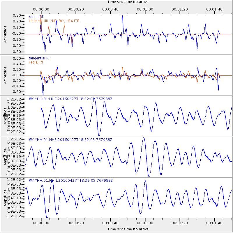
YHH Holmes Hill, YNP, WY, USA - Earthquake Result Viewer
*The percent match for this event was below the threshold and hence no stack was calculated.
| Earthquake location: |
Taiwan |
| Earthquake latitude/longitude: |
23.3/121.4 |
| Earthquake time(UTC): |
2016/04/27 (118) 18:19:05 GMT |
| Earthquake Depth: |
10 km |
| Earthquake Magnitude: |
5.0 Mww |
| Earthquake Catalog/Contributor: |
NEIC PDE/us |
|
| Network: |
WY Yellowstone Wyoming Seismic Network |
| Station: |
YHH Holmes Hill, YNP, WY, USA |
| Lat/Lon: |
44.79 N/110.85 W |
| Elevation: |
2717 m |
|
| Distance: |
97.2 deg |
| Az: |
34.568 deg |
| Baz: |
312.905 deg |
| Ray Param: |
$rayparam |
*The percent match for this event was below the threshold and hence was not used in the summary stack. |
|
| Radial Match: |
35.089344 % |
| Radial Bump: |
393 |
| Transverse Match: |
52.22817 % |
| Transverse Bump: |
400 |
| SOD ConfigId: |
7422571 |
| Insert Time: |
2019-04-22 11:43:58.311 +0000 |
| GWidth: |
2.5 |
| Max Bumps: |
400 |
| Tol: |
0.001 |
|
Signal To Noise
| Channel | StoN | STA | LTA |
| WY:YHH:01:HHZ:20160427T18:32:05.767988Z | 1.3716558 | 3.7439953E-9 | 2.7295444E-9 |
| WY:YHH:01:HHN:20160427T18:32:05.767988Z | 2.0284002 | 7.867851E-9 | 3.8788457E-9 |
| WY:YHH:01:HHE:20160427T18:32:05.767988Z | 2.0645344 | 1.0065593E-8 | 4.8754782E-9 |
| Arrivals |
| Ps | |
| PpPs | |
| PsPs/PpSs | |


