You are here: Home > Network List > US - United States National Seismic Network Stations List
> Station MSO Missoula, Montana, USA > Earthquake Result Viewer
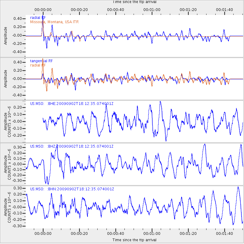
MSO Missoula, Montana, USA - Earthquake Result Viewer
*The percent match for this event was below the threshold and hence no stack was calculated.
| Earthquake location: |
Kermadec Islands, New Zealand |
| Earthquake latitude/longitude: |
-29.4/-179.0 |
| Earthquake time(UTC): |
2009/09/02 (245) 18:00:11 GMT |
| Earthquake Depth: |
275 km |
| Earthquake Magnitude: |
5.8 MB, 6.2 MW, 6.1 MW |
| Earthquake Catalog/Contributor: |
WHDF/NEIC |
|
| Network: |
US United States National Seismic Network |
| Station: |
MSO Missoula, Montana, USA |
| Lat/Lon: |
46.83 N/113.94 W |
| Elevation: |
1264 m |
|
| Distance: |
95.8 deg |
| Az: |
38.726 deg |
| Baz: |
232.694 deg |
| Ray Param: |
$rayparam |
*The percent match for this event was below the threshold and hence was not used in the summary stack. |
|
| Radial Match: |
54.55262 % |
| Radial Bump: |
400 |
| Transverse Match: |
61.878136 % |
| Transverse Bump: |
400 |
| SOD ConfigId: |
2622 |
| Insert Time: |
2010-03-05 02:19:58.901 +0000 |
| GWidth: |
2.5 |
| Max Bumps: |
400 |
| Tol: |
0.001 |
|
Signal To Noise
| Channel | StoN | STA | LTA |
| US:MSO: :BHZ:20090902T18:12:35.074001Z | 2.7860997 | 2.2077208E-7 | 7.924055E-8 |
| US:MSO: :BHN:20090902T18:12:35.074001Z | 1.0566925 | 1.208513E-7 | 1.1436752E-7 |
| US:MSO: :BHE:20090902T18:12:35.074001Z | 1.8625133 | 1.3642543E-7 | 7.324803E-8 |
| Arrivals |
| Ps | |
| PpPs | |
| PsPs/PpSs | |


