You are here: Home > Network List > US - United States National Seismic Network Stations List
> Station MSO Missoula, Montana, USA > Earthquake Result Viewer
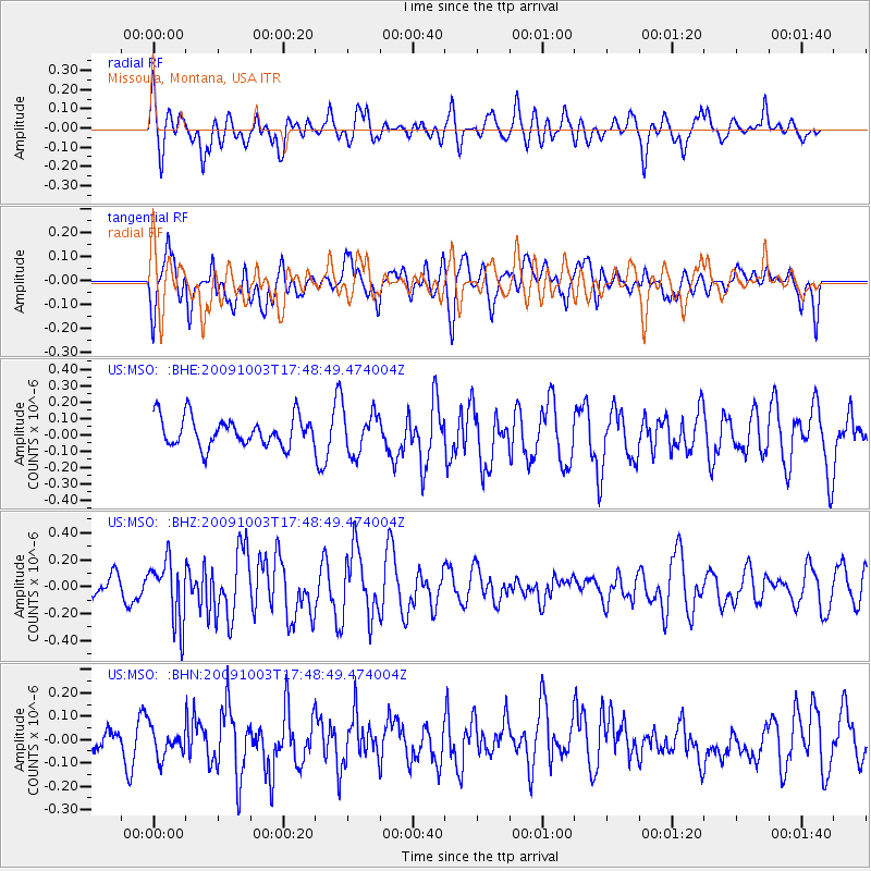
MSO Missoula, Montana, USA - Earthquake Result Viewer
*The percent match for this event was below the threshold and hence no stack was calculated.
| Earthquake location: |
Taiwan |
| Earthquake latitude/longitude: |
23.6/121.5 |
| Earthquake time(UTC): |
2009/10/03 (276) 17:36:06 GMT |
| Earthquake Depth: |
28 km |
| Earthquake Magnitude: |
6.0 MB, 5.7 MS, 6.0 MW, 6.1 MW |
| Earthquake Catalog/Contributor: |
WHDF/NEIC |
|
| Network: |
US United States National Seismic Network |
| Station: |
MSO Missoula, Montana, USA |
| Lat/Lon: |
46.83 N/113.94 W |
| Elevation: |
1264 m |
|
| Distance: |
93.9 deg |
| Az: |
34.502 deg |
| Baz: |
310.834 deg |
| Ray Param: |
$rayparam |
*The percent match for this event was below the threshold and hence was not used in the summary stack. |
|
| Radial Match: |
60.60221 % |
| Radial Bump: |
400 |
| Transverse Match: |
57.88925 % |
| Transverse Bump: |
400 |
| SOD ConfigId: |
2622 |
| Insert Time: |
2010-03-05 02:20:13.867 +0000 |
| GWidth: |
2.5 |
| Max Bumps: |
400 |
| Tol: |
0.001 |
|
Signal To Noise
| Channel | StoN | STA | LTA |
| US:MSO: :BHZ:20091003T17:48:49.474004Z | 2.2150183 | 2.2906757E-7 | 1.0341566E-7 |
| US:MSO: :BHN:20091003T17:48:49.474004Z | 1.0142832 | 7.7861124E-8 | 7.6764685E-8 |
| US:MSO: :BHE:20091003T17:48:49.474004Z | 1.47223 | 1.304971E-7 | 8.863908E-8 |
| Arrivals |
| Ps | |
| PpPs | |
| PsPs/PpSs | |


