You are here: Home > Network List > US - United States National Seismic Network Stations List
> Station MSO Missoula, Montana, USA > Earthquake Result Viewer
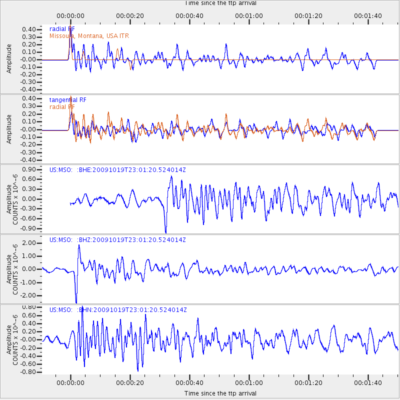
MSO Missoula, Montana, USA - Earthquake Result Viewer
*The percent match for this event was below the threshold and hence no stack was calculated.
| Earthquake location: |
Samoa Islands Region |
| Earthquake latitude/longitude: |
-15.4/-172.3 |
| Earthquake time(UTC): |
2009/10/19 (292) 22:49:38 GMT |
| Earthquake Depth: |
18 km |
| Earthquake Magnitude: |
6.2 MB, 5.7 MS, 6.0 MW, 5.9 MW |
| Earthquake Catalog/Contributor: |
WHDF/NEIC |
|
| Network: |
US United States National Seismic Network |
| Station: |
MSO Missoula, Montana, USA |
| Lat/Lon: |
46.83 N/113.94 W |
| Elevation: |
1264 m |
|
| Distance: |
81.0 deg |
| Az: |
36.272 deg |
| Baz: |
236.227 deg |
| Ray Param: |
$rayparam |
*The percent match for this event was below the threshold and hence was not used in the summary stack. |
|
| Radial Match: |
83.72608 % |
| Radial Bump: |
400 |
| Transverse Match: |
72.98151 % |
| Transverse Bump: |
400 |
| SOD ConfigId: |
2622 |
| Insert Time: |
2010-03-05 02:20:17.739 +0000 |
| GWidth: |
2.5 |
| Max Bumps: |
400 |
| Tol: |
0.001 |
|
Signal To Noise
| Channel | StoN | STA | LTA |
| US:MSO: :BHZ:20091019T23:01:20.524014Z | 7.2519593 | 9.852538E-7 | 1.3586036E-7 |
| US:MSO: :BHN:20091019T23:01:20.524014Z | 2.964448 | 3.4394407E-7 | 1.16022974E-7 |
| US:MSO: :BHE:20091019T23:01:20.524014Z | 3.7045298 | 4.367438E-7 | 1.1789453E-7 |
| Arrivals |
| Ps | |
| PpPs | |
| PsPs/PpSs | |


