You are here: Home > Network List > AV - Alaska Volcano Observatory Stations List
> Station MAPS Pakushin Southeast, Makushin Volcano, Alaska > Earthquake Result Viewer
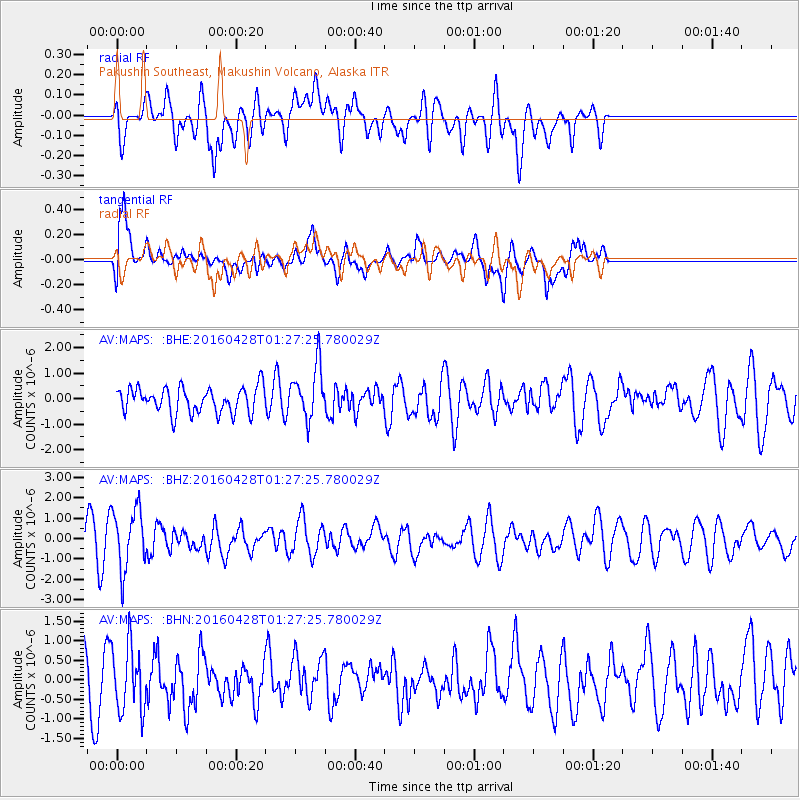
MAPS Pakushin Southeast, Makushin Volcano, Alaska - Earthquake Result Viewer
*The percent match for this event was below the threshold and hence no stack was calculated.
| Earthquake location: |
Solomon Islands |
| Earthquake latitude/longitude: |
-6.1/155.0 |
| Earthquake time(UTC): |
2016/04/28 (119) 01:17:13 GMT |
| Earthquake Depth: |
128 km |
| Earthquake Magnitude: |
5.6 MB |
| Earthquake Catalog/Contributor: |
NEIC PDE/NEIC ALERT |
|
| Network: |
AV Alaska Volcano Observatory |
| Station: |
MAPS Pakushin Southeast, Makushin Volcano, Alaska |
| Lat/Lon: |
53.81 N/166.94 W |
| Elevation: |
333 m |
|
| Distance: |
67.7 deg |
| Az: |
23.295 deg |
| Baz: |
221.537 deg |
| Ray Param: |
$rayparam |
*The percent match for this event was below the threshold and hence was not used in the summary stack. |
|
| Radial Match: |
34.23877 % |
| Radial Bump: |
400 |
| Transverse Match: |
81.12126 % |
| Transverse Bump: |
400 |
| SOD ConfigId: |
7422571 |
| Insert Time: |
2019-04-22 11:46:29.946 +0000 |
| GWidth: |
2.5 |
| Max Bumps: |
400 |
| Tol: |
0.001 |
|
Signal To Noise
| Channel | StoN | STA | LTA |
| AV:MAPS: :BHZ:20160428T01:27:25.780029Z | 1.5438203 | 1.4842893E-6 | 9.614391E-7 |
| AV:MAPS: :BHN:20160428T01:27:25.780029Z | 0.8946033 | 8.405737E-7 | 9.3960494E-7 |
| AV:MAPS: :BHE:20160428T01:27:25.780029Z | 2.0941901 | 1.0476131E-6 | 5.002474E-7 |
| Arrivals |
| Ps | |
| PpPs | |
| PsPs/PpSs | |


