You are here: Home > Network List > US - United States National Seismic Network Stations List
> Station MSO Missoula, Montana, USA > Earthquake Result Viewer
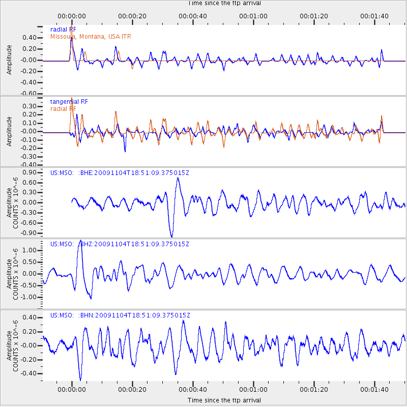
MSO Missoula, Montana, USA - Earthquake Result Viewer
*The percent match for this event was below the threshold and hence no stack was calculated.
| Earthquake location: |
Azores Islands Region |
| Earthquake latitude/longitude: |
36.2/-33.9 |
| Earthquake time(UTC): |
2009/11/04 (308) 18:41:44 GMT |
| Earthquake Depth: |
10 km |
| Earthquake Magnitude: |
5.7 MB, 5.6 MS, 5.9 MW, 5.8 MW |
| Earthquake Catalog/Contributor: |
WHDF/NEIC |
|
| Network: |
US United States National Seismic Network |
| Station: |
MSO Missoula, Montana, USA |
| Lat/Lon: |
46.83 N/113.94 W |
| Elevation: |
1264 m |
|
| Distance: |
58.5 deg |
| Az: |
307.492 deg |
| Baz: |
69.264 deg |
| Ray Param: |
$rayparam |
*The percent match for this event was below the threshold and hence was not used in the summary stack. |
|
| Radial Match: |
60.19399 % |
| Radial Bump: |
400 |
| Transverse Match: |
73.081726 % |
| Transverse Bump: |
400 |
| SOD ConfigId: |
2622 |
| Insert Time: |
2010-03-05 02:20:21.609 +0000 |
| GWidth: |
2.5 |
| Max Bumps: |
400 |
| Tol: |
0.001 |
|
Signal To Noise
| Channel | StoN | STA | LTA |
| US:MSO: :BHZ:20091104T18:51:09.375015Z | 3.6180613 | 7.2721133E-7 | 2.0099475E-7 |
| US:MSO: :BHN:20091104T18:51:09.375015Z | 1.7358059 | 2.1542718E-7 | 1.2410787E-7 |
| US:MSO: :BHE:20091104T18:51:09.375015Z | 4.6922617 | 5.0363496E-7 | 1.0733309E-7 |
| Arrivals |
| Ps | |
| PpPs | |
| PsPs/PpSs | |


