You are here: Home > Network List > US - United States National Seismic Network Stations List
> Station MSO Missoula, Montana, USA > Earthquake Result Viewer
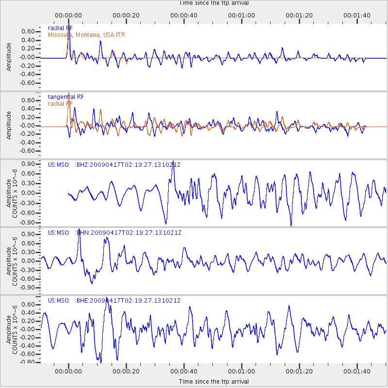
MSO Missoula, Montana, USA - Earthquake Result Viewer
*The percent match for this event was below the threshold and hence no stack was calculated.
| Earthquake location: |
Near Coast Of Northern Chile |
| Earthquake latitude/longitude: |
-19.6/-70.5 |
| Earthquake time(UTC): |
2009/04/17 (107) 02:08:08 GMT |
| Earthquake Depth: |
25 km |
| Earthquake Magnitude: |
5.8 MB, 5.8 MS, 6.1 MW, 6.1 MW |
| Earthquake Catalog/Contributor: |
WHDF/NEIC |
|
| Network: |
US United States National Seismic Network |
| Station: |
MSO Missoula, Montana, USA |
| Lat/Lon: |
46.83 N/113.94 W |
| Elevation: |
1264 m |
|
| Distance: |
76.8 deg |
| Az: |
330.987 deg |
| Baz: |
138.24 deg |
| Ray Param: |
$rayparam |
*The percent match for this event was below the threshold and hence was not used in the summary stack. |
|
| Radial Match: |
45.841473 % |
| Radial Bump: |
400 |
| Transverse Match: |
48.856915 % |
| Transverse Bump: |
400 |
| SOD ConfigId: |
2658 |
| Insert Time: |
2010-03-05 02:20:22.244 +0000 |
| GWidth: |
2.5 |
| Max Bumps: |
400 |
| Tol: |
0.001 |
|
Signal To Noise
| Channel | StoN | STA | LTA |
| US:MSO: :BHN:20090417T02:19:27.131021Z | 4.0391974 | 3.8054912E-7 | 9.4214045E-8 |
| US:MSO: :BHE:20090417T02:19:27.131021Z | 0.97551966 | 1.9179211E-7 | 1.9660507E-7 |
| US:MSO: :BHZ:20090417T02:19:27.131021Z | 2.5142975 | 4.302814E-7 | 1.7113385E-7 |
| Arrivals |
| Ps | |
| PpPs | |
| PsPs/PpSs | |


