You are here: Home > Network List > US - United States National Seismic Network Stations List
> Station MSO Missoula, Montana, USA > Earthquake Result Viewer
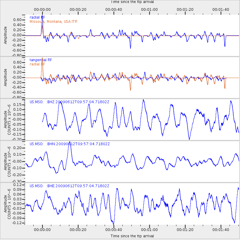
MSO Missoula, Montana, USA - Earthquake Result Viewer
*The percent match for this event was below the threshold and hence no stack was calculated.
| Earthquake location: |
Vanuatu Islands |
| Earthquake latitude/longitude: |
-17.6/167.8 |
| Earthquake time(UTC): |
2009/06/12 (163) 09:44:15 GMT |
| Earthquake Depth: |
15 km |
| Earthquake Magnitude: |
5.5 MB, 5.6 MS, 6.0 MW, 6.0 MW |
| Earthquake Catalog/Contributor: |
WHDF/NEIC |
|
| Network: |
US United States National Seismic Network |
| Station: |
MSO Missoula, Montana, USA |
| Lat/Lon: |
46.83 N/113.94 W |
| Elevation: |
1264 m |
|
| Distance: |
94.9 deg |
| Az: |
42.429 deg |
| Baz: |
249.575 deg |
| Ray Param: |
$rayparam |
*The percent match for this event was below the threshold and hence was not used in the summary stack. |
|
| Radial Match: |
60.56505 % |
| Radial Bump: |
400 |
| Transverse Match: |
66.41617 % |
| Transverse Bump: |
400 |
| SOD ConfigId: |
2648 |
| Insert Time: |
2010-03-05 02:20:34.405 +0000 |
| GWidth: |
2.5 |
| Max Bumps: |
400 |
| Tol: |
0.001 |
|
Signal To Noise
| Channel | StoN | STA | LTA |
| US:MSO: :BHN:20090612T09:57:04.71802Z | 1.5288906 | 9.0621455E-8 | 5.927269E-8 |
| US:MSO: :BHE:20090612T09:57:04.71802Z | 1.1183155 | 4.8899118E-8 | 4.372569E-8 |
| US:MSO: :BHZ:20090612T09:57:04.71802Z | 0.93045074 | 7.031658E-8 | 7.55726E-8 |
| Arrivals |
| Ps | |
| PpPs | |
| PsPs/PpSs | |


