You are here: Home > Network List > TA - USArray Transportable Network (new EarthScope stations) Stations List
> Station A21K Barrow, AK, USA > Earthquake Result Viewer
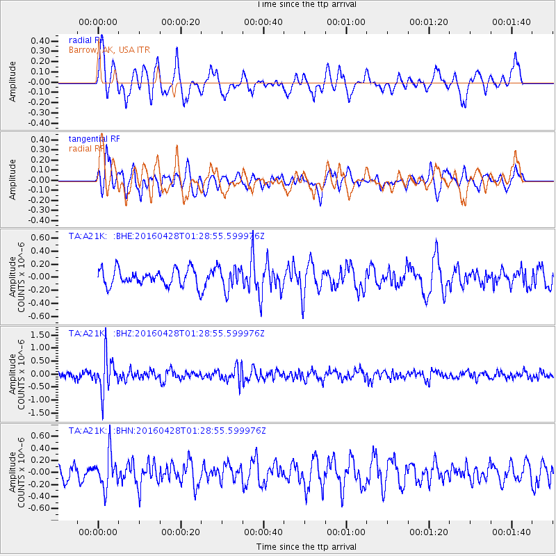
A21K Barrow, AK, USA - Earthquake Result Viewer
*The percent match for this event was below the threshold and hence no stack was calculated.
| Earthquake location: |
Solomon Islands |
| Earthquake latitude/longitude: |
-6.1/155.0 |
| Earthquake time(UTC): |
2016/04/28 (119) 01:17:13 GMT |
| Earthquake Depth: |
128 km |
| Earthquake Magnitude: |
5.6 MB |
| Earthquake Catalog/Contributor: |
NEIC PDE/NEIC ALERT |
|
| Network: |
TA USArray Transportable Network (new EarthScope stations) |
| Station: |
A21K Barrow, AK, USA |
| Lat/Lon: |
71.32 N/156.62 W |
| Elevation: |
577 m |
|
| Distance: |
83.5 deg |
| Az: |
14.036 deg |
| Baz: |
228.471 deg |
| Ray Param: |
$rayparam |
*The percent match for this event was below the threshold and hence was not used in the summary stack. |
|
| Radial Match: |
76.98803 % |
| Radial Bump: |
400 |
| Transverse Match: |
55.979362 % |
| Transverse Bump: |
400 |
| SOD ConfigId: |
7422571 |
| Insert Time: |
2019-04-22 11:49:28.537 +0000 |
| GWidth: |
2.5 |
| Max Bumps: |
400 |
| Tol: |
0.001 |
|
Signal To Noise
| Channel | StoN | STA | LTA |
| TA:A21K: :BHZ:20160428T01:28:55.599976Z | 6.4557524 | 6.8010246E-7 | 1.05348285E-7 |
| TA:A21K: :BHN:20160428T01:28:55.599976Z | 2.2131228 | 2.872152E-7 | 1.2977824E-7 |
| TA:A21K: :BHE:20160428T01:28:55.599976Z | 1.4551356 | 1.7626283E-7 | 1.2113156E-7 |
| Arrivals |
| Ps | |
| PpPs | |
| PsPs/PpSs | |


