You are here: Home > Network List > TA - USArray Transportable Network (new EarthScope stations) Stations List
> Station J26L Joseph Creek, AK, USA > Earthquake Result Viewer
J26L Joseph Creek, AK, USA - Earthquake Result Viewer
*The percent match for this event was below the threshold and hence no stack was calculated.
| Earthquake location: |
Solomon Islands |
| Earthquake latitude/longitude: |
-6.1/155.0 |
| Earthquake time(UTC): |
2016/04/28 (119) 01:17:13 GMT |
| Earthquake Depth: |
128 km |
| Earthquake Magnitude: |
5.6 MB |
| Earthquake Catalog/Contributor: |
NEIC PDE/NEIC ALERT |
|
| Network: |
TA USArray Transportable Network (new EarthScope stations) |
| Station: |
J26L Joseph Creek, AK, USA |
| Lat/Lon: |
64.50 N/143.56 W |
| Elevation: |
1144 m |
|
| Distance: |
83.6 deg |
| Az: |
22.497 deg |
| Baz: |
241.533 deg |
| Ray Param: |
$rayparam |
*The percent match for this event was below the threshold and hence was not used in the summary stack. |
|
| Radial Match: |
54.916077 % |
| Radial Bump: |
400 |
| Transverse Match: |
78.83168 % |
| Transverse Bump: |
400 |
| SOD ConfigId: |
7422571 |
| Insert Time: |
2019-04-22 11:49:38.599 +0000 |
| GWidth: |
2.5 |
| Max Bumps: |
400 |
| Tol: |
0.001 |
|
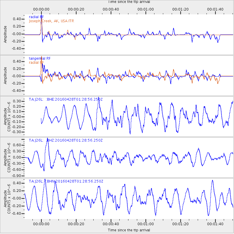
Signal To Noise
| Channel | StoN | STA | LTA |
| TA:J26L: :BHZ:20160428T01:28:56.250Z | 3.7426472 | 5.3227166E-7 | 1.4221796E-7 |
| TA:J26L: :BHN:20160428T01:28:56.250Z | 2.61606 | 3.0136286E-7 | 1.1519723E-7 |
| TA:J26L: :BHE:20160428T01:28:56.250Z | 1.697939 | 2.179226E-7 | 1.2834536E-7 |
| Arrivals |
| Ps | |
| PpPs | |
| PsPs/PpSs | |


