You are here: Home > Network List > US - United States National Seismic Network Stations List
> Station MSO Missoula, Montana, USA > Earthquake Result Viewer
MSO Missoula, Montana, USA - Earthquake Result Viewer
*The percent match for this event was below the threshold and hence no stack was calculated.
| Earthquake location: |
Near Coast Of Northern Peru |
| Earthquake latitude/longitude: |
-5.7/-81.3 |
| Earthquake time(UTC): |
2009/03/26 (085) 17:35:14 GMT |
| Earthquake Depth: |
10 km |
| Earthquake Magnitude: |
5.6 MB, 5.5 MS, 5.8 MW, 5.7 MW |
| Earthquake Catalog/Contributor: |
WHDF/NEIC |
|
| Network: |
US United States National Seismic Network |
| Station: |
MSO Missoula, Montana, USA |
| Lat/Lon: |
46.83 N/113.94 W |
| Elevation: |
1264 m |
|
| Distance: |
59.8 deg |
| Az: |
334.645 deg |
| Baz: |
141.64 deg |
| Ray Param: |
$rayparam |
*The percent match for this event was below the threshold and hence was not used in the summary stack. |
|
| Radial Match: |
50.170795 % |
| Radial Bump: |
400 |
| Transverse Match: |
53.63786 % |
| Transverse Bump: |
400 |
| SOD ConfigId: |
2658 |
| Insert Time: |
2010-03-05 02:20:53.998 +0000 |
| GWidth: |
2.5 |
| Max Bumps: |
400 |
| Tol: |
0.001 |
|
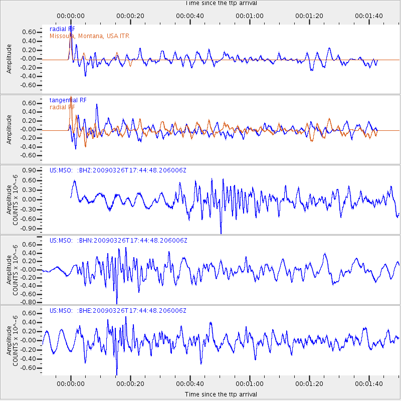
Signal To Noise
| Channel | StoN | STA | LTA |
| US:MSO: :BHN:20090326T17:44:48.206006Z | 2.714889 | 1.238298E-7 | 4.561137E-8 |
| US:MSO: :BHE:20090326T17:44:48.206006Z | 1.5967041 | 2.0204217E-7 | 1.2653702E-7 |
| US:MSO: :BHZ:20090326T17:44:48.206006Z | 1.0377498 | 1.7692115E-7 | 1.7048536E-7 |
| Arrivals |
| Ps | |
| PpPs | |
| PsPs/PpSs | |


