You are here: Home > Network List > US - United States National Seismic Network Stations List
> Station MSO Missoula, Montana, USA > Earthquake Result Viewer
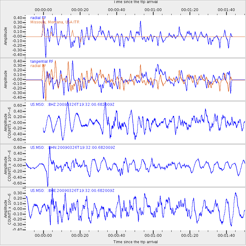
MSO Missoula, Montana, USA - Earthquake Result Viewer
*The percent match for this event was below the threshold and hence no stack was calculated.
| Earthquake location: |
Northwest Of Ryukyu Islands |
| Earthquake latitude/longitude: |
27.4/126.7 |
| Earthquake time(UTC): |
2009/03/26 (085) 19:19:59 GMT |
| Earthquake Depth: |
160 km |
| Earthquake Magnitude: |
5.6 MB, 5.9 MW, 5.9 MW |
| Earthquake Catalog/Contributor: |
WHDF/NEIC |
|
| Network: |
US United States National Seismic Network |
| Station: |
MSO Missoula, Montana, USA |
| Lat/Lon: |
46.83 N/113.94 W |
| Elevation: |
1264 m |
|
| Distance: |
88.1 deg |
| Az: |
36.783 deg |
| Baz: |
309.174 deg |
| Ray Param: |
$rayparam |
*The percent match for this event was below the threshold and hence was not used in the summary stack. |
|
| Radial Match: |
55.897594 % |
| Radial Bump: |
400 |
| Transverse Match: |
45.469433 % |
| Transverse Bump: |
400 |
| SOD ConfigId: |
2658 |
| Insert Time: |
2010-03-05 02:20:59.484 +0000 |
| GWidth: |
2.5 |
| Max Bumps: |
400 |
| Tol: |
0.001 |
|
Signal To Noise
| Channel | StoN | STA | LTA |
| US:MSO: :BHN:20090326T19:32:00.682009Z | 2.9611762 | 2.936044E-7 | 9.915128E-8 |
| US:MSO: :BHE:20090326T19:32:00.682009Z | 1.2056575 | 1.2167465E-7 | 1.0091974E-7 |
| US:MSO: :BHZ:20090326T19:32:00.682009Z | 1.1551816 | 3.054429E-7 | 2.6441114E-7 |
| Arrivals |
| Ps | |
| PpPs | |
| PsPs/PpSs | |


