You are here: Home > Network List > TA - USArray Transportable Network (new EarthScope stations) Stations List
> Station J01E Myrtle Point, OR, USA > Earthquake Result Viewer
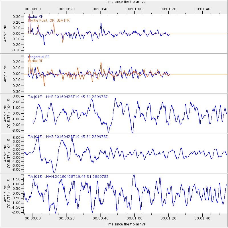
J01E Myrtle Point, OR, USA - Earthquake Result Viewer
*The percent match for this event was below the threshold and hence no stack was calculated.
| Earthquake location: |
Vanuatu Islands |
| Earthquake latitude/longitude: |
-16.1/167.3 |
| Earthquake time(UTC): |
2016/04/28 (119) 19:33:27 GMT |
| Earthquake Depth: |
35 km |
| Earthquake Magnitude: |
7.0 MO |
| Earthquake Catalog/Contributor: |
NEIC PDE/NEIC ALERT |
|
| Network: |
TA USArray Transportable Network (new EarthScope stations) |
| Station: |
J01E Myrtle Point, OR, USA |
| Lat/Lon: |
43.16 N/123.93 W |
| Elevation: |
128 m |
|
| Distance: |
86.1 deg |
| Az: |
43.113 deg |
| Baz: |
243.879 deg |
| Ray Param: |
$rayparam |
*The percent match for this event was below the threshold and hence was not used in the summary stack. |
|
| Radial Match: |
76.47318 % |
| Radial Bump: |
380 |
| Transverse Match: |
68.87815 % |
| Transverse Bump: |
400 |
| SOD ConfigId: |
7422571 |
| Insert Time: |
2019-04-22 11:58:38.130 +0000 |
| GWidth: |
2.5 |
| Max Bumps: |
400 |
| Tol: |
0.001 |
|
Signal To Noise
| Channel | StoN | STA | LTA |
| TA:J01E: :HHZ:20160428T19:45:31.289978Z | 5.9287405 | 4.660308E-6 | 7.860536E-7 |
| TA:J01E: :HHN:20160428T19:45:31.289978Z | 1.3706888 | 8.1053827E-7 | 5.9133646E-7 |
| TA:J01E: :HHE:20160428T19:45:31.289978Z | 1.4525445 | 1.2934015E-6 | 8.9043846E-7 |
| Arrivals |
| Ps | |
| PpPs | |
| PsPs/PpSs | |


