
LRAL Lakeview Retreat, Alabama, USA - Earthquake Result Viewer
| ||||||||||||||||||
| ||||||||||||||||||
| ||||||||||||||||||
|
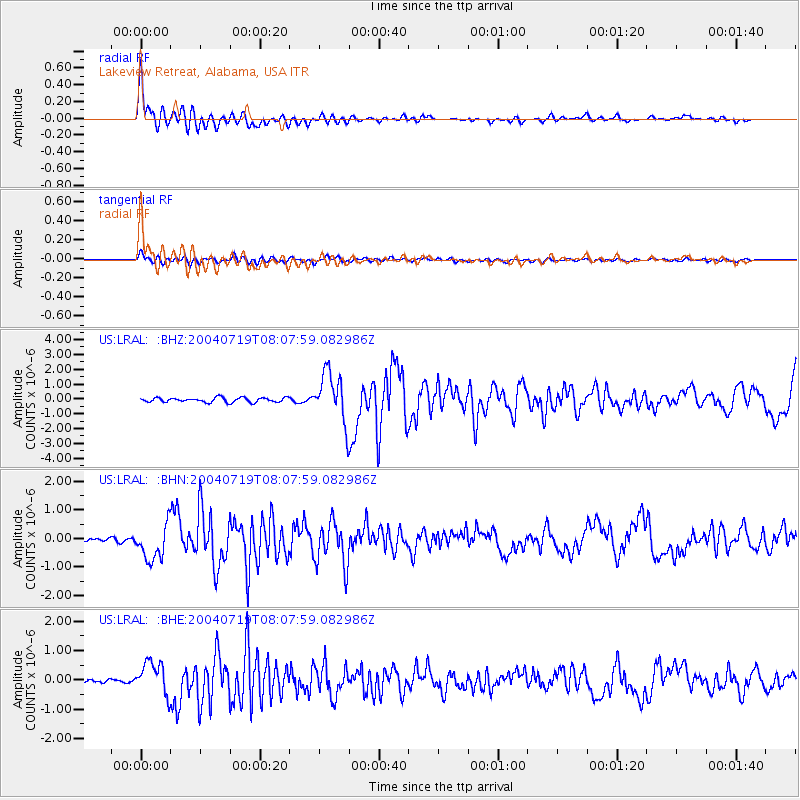
Signal To Noise
| Channel | StoN | STA | LTA |
| US:LRAL: :BHN:20040719T08:07:59.082986Z | 12.807036 | 6.2310113E-7 | 4.8653032E-8 |
| US:LRAL: :BHE:20040719T08:07:59.082986Z | 7.9704695 | 5.544059E-7 | 6.9557494E-8 |
| US:LRAL: :BHZ:20040719T08:07:59.082986Z | 10.860972 | 1.6636997E-6 | 1.5318147E-7 |
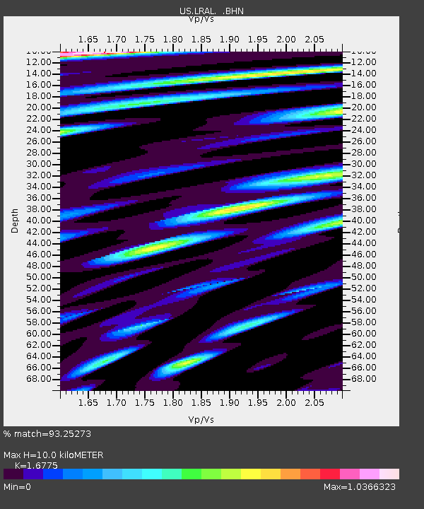
| Arrivals | |
| Ps | 1.1 SECOND |
| PpPs | 3.7 SECOND |
| PsPs/PpSs | 4.9 SECOND |

